This article contains affiliate links to booking sites. If you book through them, LOCAL SIDE JAPAN earns a small commission at no extra cost to you. The place itself is free and is described first. How this site is made →
TOKYO / KOTO CITY / WATERWAYS
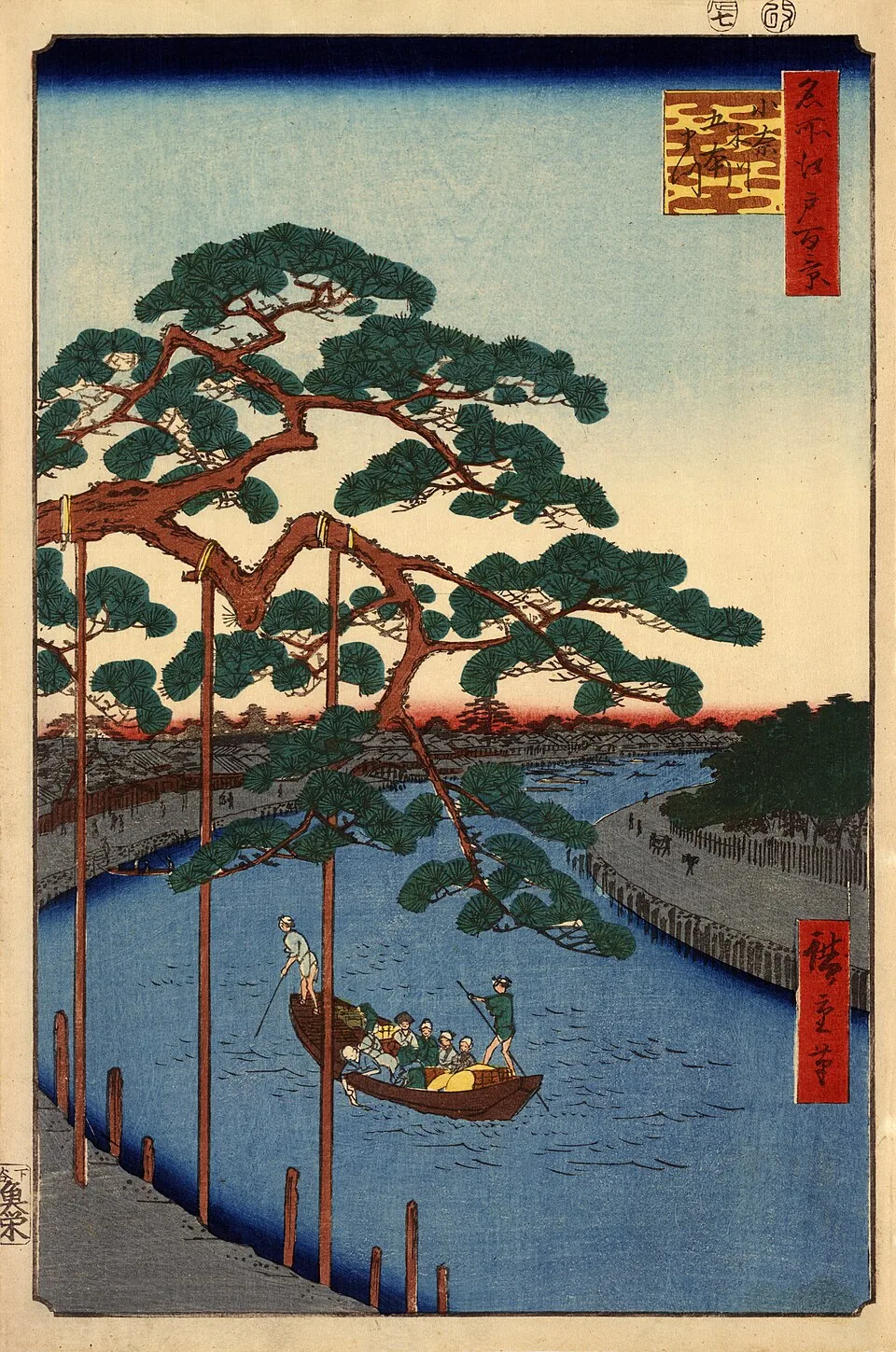
Tokyo once had a checkpoint for boats.
Before trucks, container ports and next-morning delivery, rice, salt, vegetables and people moved through Edo by water. Boats entering the city along the Onagi River could be inspected at the Nakagawa checkpoint.
The checkpoint is gone. The river is still here.
Today, you can follow this forgotten logistics route through eastern Koto City—starting with lunch at Sunamachi Ginza Shopping Street and ending beside the reconstructed checkpoint at the Nakagawa Funabansho Museum.
On this page
- Begin with the cargo you can eat
- The canal that carried salt into Edo
- Why did boats need a checkpoint?
- A museum for the Tokyo that moved by boat
- Tokyo’s river elevator
- The Old Nakagawa feels far from central Tokyo
- A practical half-day route
- Before you go
- Where this joins the rest of the east side
- Quick answers
Begin with the cargo you can eat
Start at Sunamachi Ginza hungry.
This 670-meter neighborhood shopping street is lined with independent food shops, greengrocers, fishmongers and stores selling the objects required for normal life. The prepared-food counters are the main attraction: yakitori, tempura, oden, dumplings and whatever smells best when you arrive.
Buy a few things for lunch, but remember that this is a working local market. Keep entrances clear, ask before photographing shop staff and do not turn someone’s grocery run into an obstacle course.
The food also fits the day’s story. Koto City grew through trade, waterways and the movement of everyday goods. You are about to follow one of the routes that helped feed Edo—after being fed yourself.
The canal that carried salt into Edo
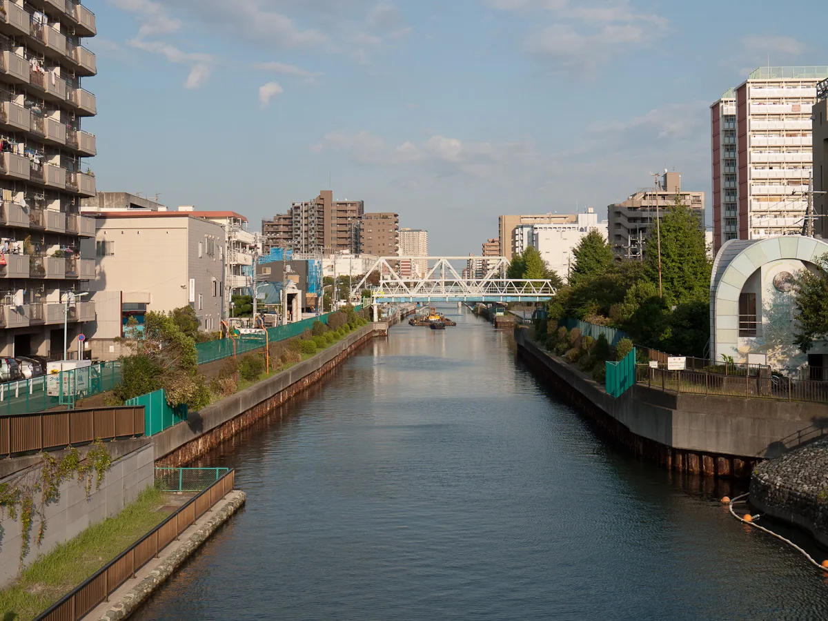
The Onagi River is not a natural river. It was cut through the low wetlands east of Edo soon after Tokugawa Ieyasu entered the city in 1590.
One of its most important jobs was carrying salt from Gyotoku, in present-day Chiba, toward Edo. Salt preserved food, supported cooking and kept a growing city alive. The canal also became a major route for rice, vegetables and other cargo arriving from eastern Japan.
Parts of the riverside are now known as the Shio no Michi—the Salt Road. The name makes it sound like an epic mountain trail. In reality, it is a calm urban walkway used by dog walkers, cyclists and residents who are not thinking about seventeenth-century supply chains.
Why did boats need a checkpoint?
Edo controlled movement carefully. In 1661, a boat checkpoint was transferred to the eastern end of the Onagi River, near its meeting with the Nakagawa waterways.
Officials monitored boats, passengers and cargo entering or leaving Edo. The system helped regulate traffic and watch for prohibited movement, including weapons and people traveling without authorization.
Think of it as border control, customs and a traffic office sharing one waterfront desk—without barcode scanners and with considerably more paperwork made from actual paper.
For years, the precise location was based largely on historical evidence. Excavations in 1995 uncovered posts, foundation stones and other remains, strongly confirming the site of the Nakagawa checkpoint.
A museum for the Tokyo that moved by boat
The Nakagawa Funabansho Museum stands about 50 meters north of the archaeological site.
Its central display reconstructs the checkpoint with a large model. Exhibits explain the boats, cargo and river systems that connected Edo with inland Kanto and the northeast. Another gallery displays traditional Japanese fishing rods and tackle.
This is not a museum of shoguns waving swords. It is a museum about systems: who moved, what they carried, where they were stopped and how an enormous city functioned before engines.
An English museum leaflet is available online. Most interpretation is easiest with translation assistance, so keep your phone’s camera-translation function ready.
Tokyo’s river elevator
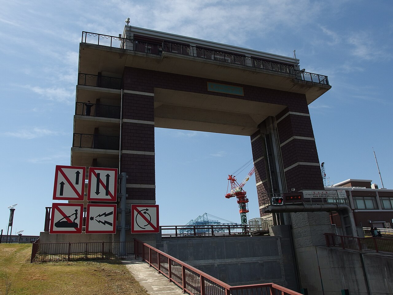
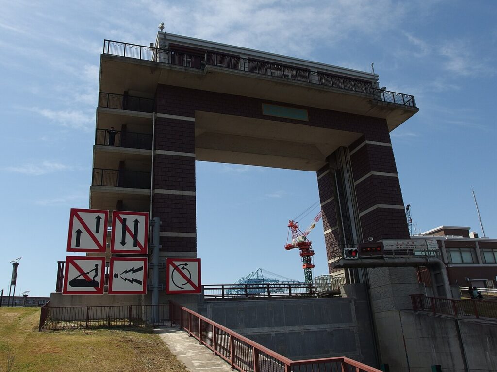
Continue toward the Arakawa Lock Gate. The concrete structure allows boats to travel between the Old Nakagawa and the Arakawa even when their water levels differ.
A boat enters the chamber, a gate closes, and the water level rises or falls before the opposite gate opens. Koto’s official tourism information describes a possible difference of up to about three meters.
Calling it a “river elevator” is more appealing than calling it hydraulic infrastructure, but both descriptions are accurate.
You may not see a boat pass during your visit. The structure is still worth seeing from the surrounding paths, especially if you enjoy the industrial side of Tokyo.
The Old Nakagawa feels far from central Tokyo
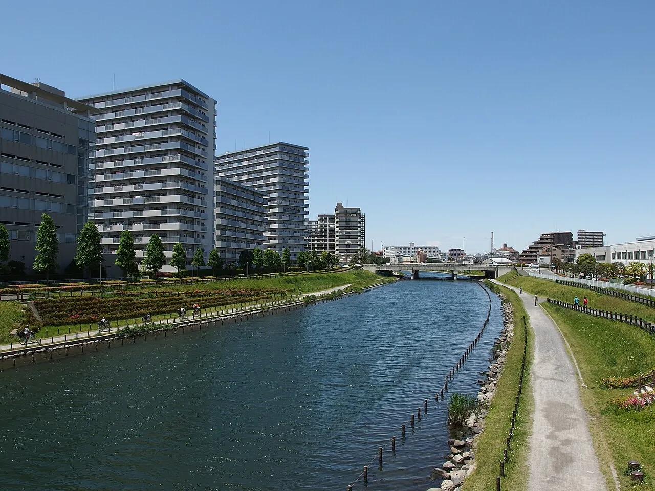
Near Higashi-Ojima Station, the canal landscape opens into the Old Nakagawa. Grassy banks, low bridges and wide skies replace the tight streets around Sunamachi.
The Kyu-Nakagawa River Station provides a small waterfront base near the meeting point of the rivers. Depending on the day, the area may host local events or boating activities. On an ordinary afternoon, it is simply a good place to stop and watch the water.
Tokyo is usually introduced vertically: towers, observation decks and buildings stacked above train stations. This part of the city makes more sense horizontally. Follow the waterways and the history connects itself.
A practical half-day route
- Sunamachi Ginza Shopping Street — arrive before lunch and explore the food counters.
- Shio no Michi Bridge and Onagi River — walk or cycle east along the canal.
- Arakawa Lock Gate — see the modern river-control structure.
- Old Komatsugawa Lock remains — a fragment of an earlier water-management system.
- Kyu-Nakagawa River Station — take a break beside the water.
- Nakagawa Funabansho Museum — finish with the reconstructed Edo checkpoint.
- Higashi-Ojima Station — the museum is about five minutes away on foot.
Allow four to five hours including lunch. A bicycle shortens the travel time, but walk it if you enjoy quiet residential streets and canals.
Before you go
- Museum address: 1-15 Ojima 9-chome, Koto City, Tokyo.
- Current museum hours: 9:30–17:00, with last admission at 16:30.
- Current museum admission: Adults ¥200; discounted youth admission is available.
- Regular closure: Mondays, or the following day when Monday is a public holiday, plus year-end and exhibition-change closures.
- Transport: Start near Sunamachi Ginza and finish at Higashi-Ojima Station. Check your preferred walking, bus or bicycle route on the day.
- Weather: Much of the route is outdoors with limited shade. Avoid the hottest afternoon hours in summer.
- Latest information: Confirm museum openings and riverside restrictions on the official websites before visiting.
Most travelers meet Edo through castles, samurai and famous temples.
Along the Onagi River, you meet the people checking cargo, steering boats and making sure the city had enough salt for dinner.
History looks different from the delivery entrance.
Researched using current information from Koto City, the Nakagawa Funabansho Museum, Koto City Tourism Association and the Sunamachi Ginza Shopping Street, checked September 11, 2026. This is a researched neighborhood guide, not a firsthand visit report. Conditions may change.
Guided or not: the only tour that covers this route is a private two-hour walk of Sunamachi Ginza with a guide (Viator, 5.0, from about ¥17,000 per group). The shopping street is the part where a guide adds something, ordering and explaining; the river walk and the museum need none, and the museum leaflet is in English. Most people should do it alone.
Sumo before the walk, if you want it
I run this one. Treat what follows as an interest declared, not a neutral recommendation — everything else on this site is chosen without one.
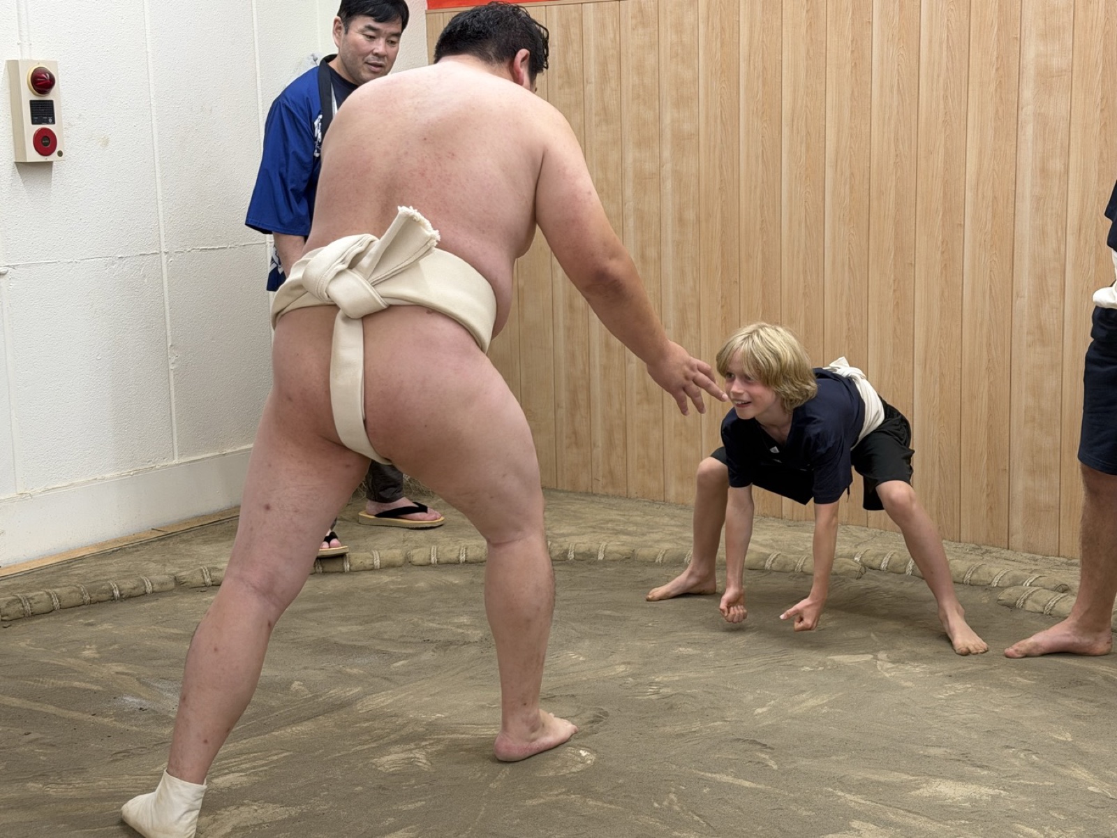
This route starts at Sunamachi Ginza, and so does the sumo stable I run. The 11:00 session finishes at 12:30, which is roughly when this walk wants you to be eating your way down the shopping street anyway — so the two fit together on one half-day without rearranging anything. Ninety minutes with former professional wrestlers: bouts from the edge of a real ring, then the ring itself if you choose to.
¥11,000 adults · ¥7,700 children 4–12 · under 4 free · 11:00 and 15:30 · 90 minutes · closed Wednesdays and Thursdays · 3-38-16 Kitasuna, a few minutes from the shopping street.
If a hands-on session is not what you want, the other three ways to see sumo — the grand tournament at the Kokugikan, a real stable’s morning practice, and the commercial shows — are compared with prices in Sumo in Tokyo: morning practice vs sumo show vs the tournament, and tournament tickets are explained in how to actually get a ¥3,500 seat. And if you are weighing up the nine individual places rather than the three kinds, we compared all of them on the four things the listings leave out: whether everyone gets in the ring or it is decided by lottery, whether you wear a real mawashi or an inflatable suit, how close you sit, and what you eat.
Where this joins the rest of the east side
The checkpoint is one end of the delta’s water story; the buried Komatsugawa lock is a few minutes further along the river, and Kiyosumi-Shirakawa, with the Fukagawa Edo Museum’s rebuilt boat landing, is the upstream end. The ¥100 boats are on the way.
The rest of the ward, in order, is in Things to Do in Koto City: 12 Places.
Quick answers
What is the Nakagawa Funabansho Museum?
A Koto City museum about the boat checkpoint that controlled river traffic into Edo from 1661, with a large reconstruction of the checkpoint, exhibits on canal cargo, and a gallery of traditional fishing tackle. It stands 50 meters from the excavated site, near Higashi-Ojima Station.
What was the Onagi River for?
It was cut in the 1590s to carry salt from Gyotoku in Chiba into Edo, and later rice, vegetables and other cargo. The riverside path is still called the Shio no Michi, the Salt Road.
How do I walk the Onagi River route?
Start with lunch at Sunamachi Ginza shopping street, follow the Yokojukken River water park north to Clover Bridge, then walk east along the Onagi River to the museum, about 3 km in total. Flat, paved, and quiet.
Why did Edo have a checkpoint for boats?
To control who and what entered the capital: cargo, passengers, weapons and unauthorized travelers. The 1995 excavation uncovered posts and foundation stones confirming the checkpoint’s location.