Kizuku

  • A Bullet Train Runs Beneath This Tokyo Shrine

    A Bullet Train Runs Beneath This Tokyo Shrine

    This article may contain affiliate links to booking sites. If you book through them, LOCAL SIDE JAPAN earns a small commission at no extra cost to you. How this site is made →

    LOCAL TOKYO · AKABANE, KITA CITY

    Akabane is famous for cheap drinks and crowded railway platforms. But climb the hill behind the station and Tokyo performs a much stranger trick: a bullet train disappears beneath the grounds of an old Shinto shrine. At Akabane Hachiman, sacred history and high-speed infrastructure occupy the same slope—without either one feeling like a museum exhibit.
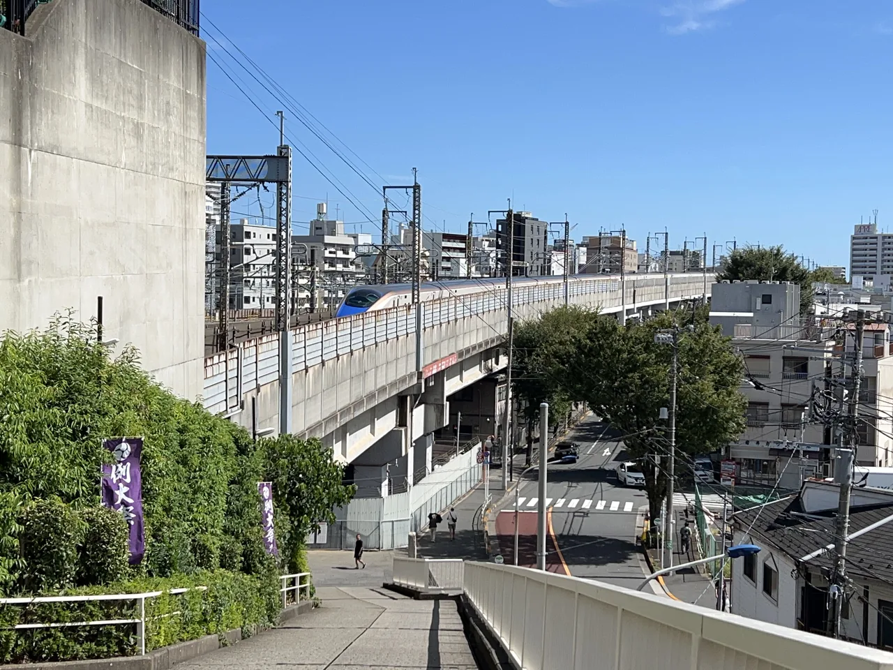
    An E7 Series Shinkansen entering Akabanedai Tunnel below Akabane Hachiman Shrine
    An E7 Series Shinkansen enters Akabanedai Tunnel beneath the shrine grounds. Photo: Asanagi / Wikimedia Commons / CC0.

    Fast facts

    • Admission: Free for normal worship visits
    • Address: 4-1-6 Akabanedai, Kita City, Tokyo
    • Nearest: JR Akabane Station, about 10 minutes on foot
    • Terrain: The shrine stands on a hill; the approach includes slopes and stone steps
    • Time needed: About 30 to 45 minutes

    The train vanishes into a sacred hill

    From the southern edge of Akabane Hachiman Shrine, trains appear between apartment blocks and railway equipment, then slip into a dark portal directly below the precinct. One moment an E7 or E5 Shinkansen is visible in full daylight; seconds later, it is beneath your feet.

    The railway line is not merely close to the shrine. The Tōhoku Shinkansen and Saikyō Line pass through Akabanedai Tunnel under part of its grounds. Trains heading toward the Tōhoku, Jōetsu and Hokuriku networks use the high-speed tracks, while ordinary commuter services continue beside them. Other major lines run through the corridor below the hill, making this one of northern Tokyo’s busiest transport gateways.

    Yet the atmosphere above is remarkably calm. Bells sound, worshippers pause before the hall and trees soften the mechanical noise. The attraction is not simply “a shrine where you can photograph trains.” It is the physical layering of Tokyo: belief above, engineering below and daily life moving through both.
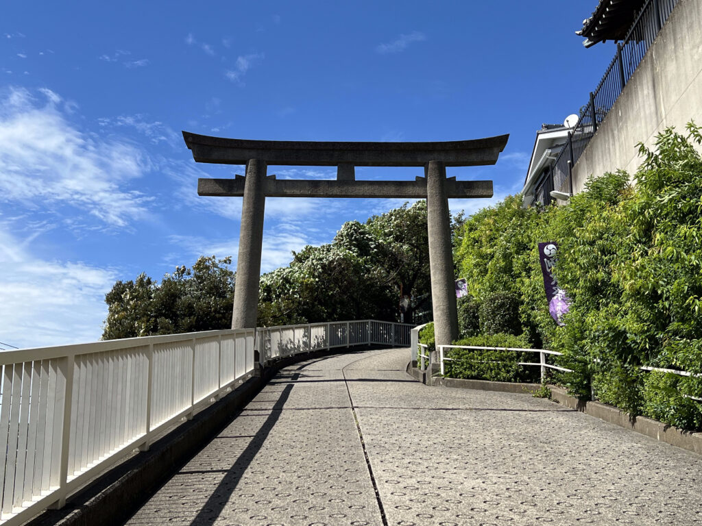
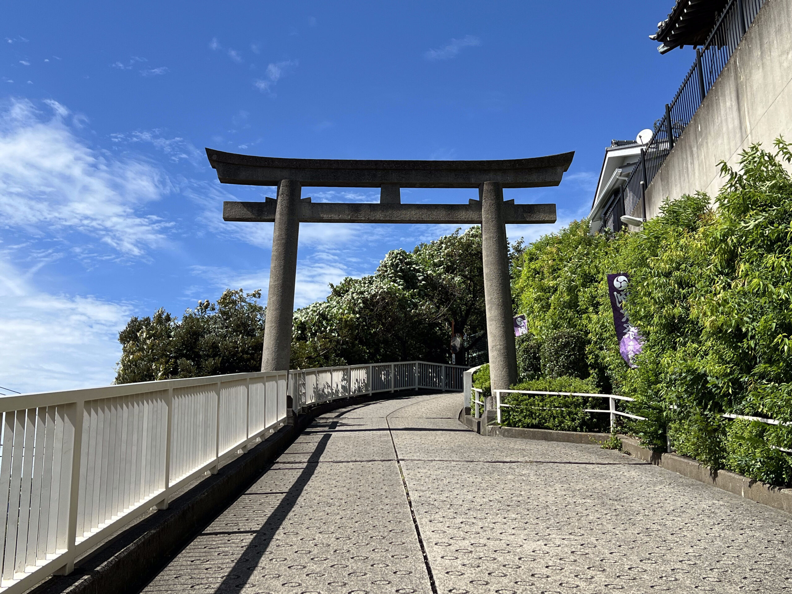
    The western approach, with the Akabanedai Tunnel portal beside the shrine hill
    The western approach, with the Akabanedai Tunnel portal beside the shrine hill. Photo: Asanagi / Wikimedia Commons / CC0.

    Why is a Shinkansen running beneath a shrine?

    The shrine occupies the northeastern edge of the Musashino terrace, a raised piece of ground overlooking the lowlands. That position once gave the site a natural sense of protection and command. Centuries later, the same narrow geography became a difficult problem for railway planners extending the Shinkansen toward Ueno.

    The solution was Akabanedai Tunnel. The railway passes beneath the edge of the sacred precinct rather than through the main sanctuary itself. The arrangement is less dramatic than the internet sometimes suggests—there is no bullet train roaring directly under the altar—but it is more interesting. A living religious institution and an essential national railway were made to coexist within a few metres of one another.

    As Shinkansen services expanded during the 1990s, more destinations became connected to the tracks below the shrine. Today a small tunnel entrance in Akabane carries trains that may continue hundreds of kilometres into northern and central Japan. Above it, local residents still arrive for an ordinary prayer.

    The shrine’s history begins with a warrior legend

    According to shrine tradition, Akabane Hachiman was founded in 784, when the military commander Sakanoue no Tamuramaro stopped here during an eastern campaign and enshrined Hachiman. As with many foundation stories from early Japan, this should be understood as sacred tradition rather than a modern documentary record.

    Later accounts connect the shrine to the warrior Minamoto no Yorimitsu and Minamoto no Yorimasa. In 1469, Ōta Dōkan—the samurai commander associated with the construction of Edo Castle—rebuilt it after land was donated by his father, Ōta Dōshin. During the Edo period, the third Tokugawa shogun, Iemitsu, granted the shrine land valued at seven koku, a privilege continued by later shoguns.

    Akabane Hachiman historically served as a guardian shrine for several surrounding communities, including old Akabane, Shimo, Fukuro, Iwabuchi-juku and Inatsuki. It was not a remote mountain sanctuary. It belonged to the settlements and roads of northern Edo long before the district became a railway hub.
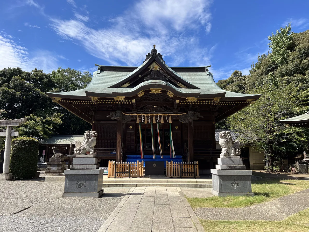
    The worship hall of Akabane Hachiman Shrine surrounded by trees in northern Tokyo
    The shrine’s worship hall above the busy railway corridor. Photo: Asanagi / Wikimedia Commons / CC0.

    A place to pray for victory

    Hachiman is closely associated with warriors and protection. That connection has not disappeared; it has simply changed form. Students come to pray before examinations, and athletes ask for success in competition. The shrine’s official history describes it as a place for victory prayers, linking modern ambitions to its old military associations.

    The present worship hall was completed in 1931. The main sanctuary was rebuilt and repaired in 1988, after the railway works had transformed the ground below. Look around and the shrine reveals several historical layers at once: old stone monuments, twentieth-century buildings, smaller subsidiary shrines and the infrastructure of contemporary Tokyo.

    One object worth finding is the nade-ushi, or “stroking ox.” Visitors traditionally touch the ox figure while making a wish for health or relief from illness. It is a quiet, tactile ritual far removed from the speed and scale of the trains below.

    The climb explains the place

    Do not treat the slope as an inconvenience. The approach is the key to understanding why the shrine feels different. Akabane Station begins in dense, noisy, commercial Tokyo. Walk west and the road starts to rise. Stairs and sloping paths pull you above the tracks until the towers, platforms and railway lines sit below the trees.
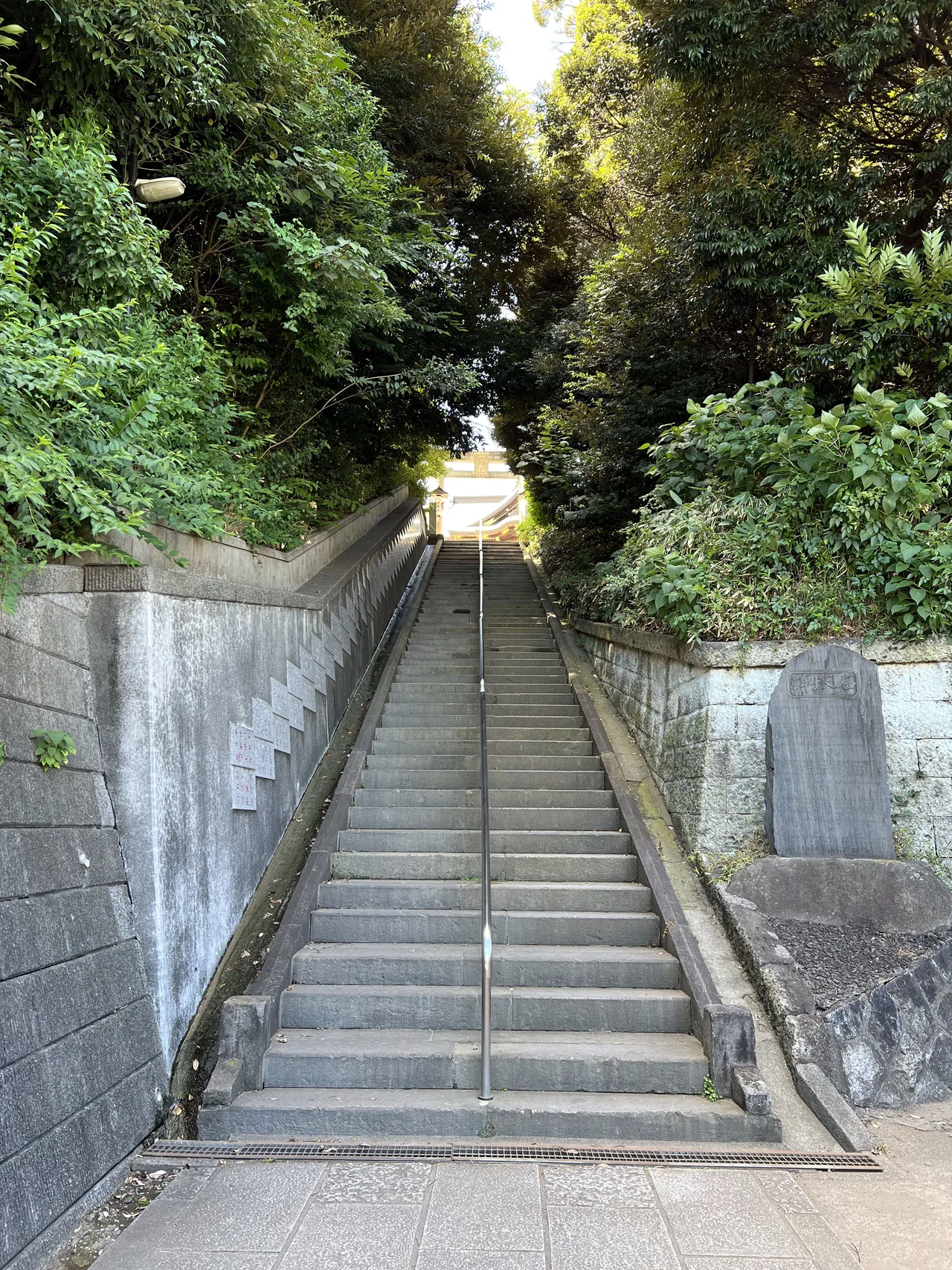
    Stone steps climbing the wooded approach to Akabane Hachiman Shrine
    Stone steps climb from the modern railway district toward the shrine precinct. Photo: Asanagi / Wikimedia Commons / CC0.

    At the top, the city has not vanished. You can still hear it and see fragments of it through the grounds. That tension is the experience: Akabane Hachiman does not offer an escape from Tokyo, but a view into how Tokyo is assembled.

    Where to watch the trains

    The most direct view is near the southern and western side of the grounds, where the Shinkansen and Saikyō Line tracks approach the tunnel. The western worshipper’s path also makes the relationship between the torii, slope and tunnel especially clear. Trains pass frequently, so there is usually no need to wait long in daylight.

    This remains a shrine, not a railway observation deck. Stay behind fences and barriers, keep paths clear, avoid large tripods and never lean toward railway property for a better angle. If a ceremony or group of worshippers is present, put the camera away and give them space.

    Build a local Akabane half-day

    1. Start at JR Akabane Station. Leave the shopping streets slowly and notice how quickly the terrain changes west of the tracks.
    2. Climb to Akabane Hachiman. Visit the worship hall before heading to the railway-viewing edge.
    3. Watch one Shinkansen disappear. The moment is brief, but the contrast makes more sense after seeing the shrine first.
    4. Return through Akabane’s local streets. The izakaya alleys east of the station show a completely different layer of the same neighbourhood.
    5. Continue south to Ōji. For another northern Tokyo landscape shaped by old belief, follow our guide to Ōji’s fox shrines and hidden local streets.

    Before you go

    • Name: Akabane Hachiman Shrine (Akabane Hachiman Jinja)
    • Address: 4-1-6 Akabanedai, Kita-ku, Tokyo
    • Access: About 10 minutes on foot from JR Akabane Station
    • Admission: Free for normal worship visits
    • Best time: Daylight, when the approaches and railway view are easiest to see
    • Terrain: The shrine stands on a hill; the approach includes slopes and stone steps
    • Time needed: About 30–45 minutes
    • Train view: Services are frequent, but exact train types and times vary
    • Etiquette: Bow at the torii, keep voices low, do not photograph worshippers without permission and follow all signs around the railway boundary.

    Where this joins the rest of the east side

    Akabane is the top of the east side’s northern arc. One stop south is Oji, the fox town, with its free hillside railway; JR Itabashi, two stops away, has the Shinsengumi memorial beside the station. Akabane’s own reputation is for cheap drinking (senbero, explained), and the same standing-bar culture runs east along the Joban line to Kita-Senju.

    Quick answers

    Where is Akabane Hachiman Shrine and how do I get there?

    On the hill directly behind JR Akabane Station in Kita City, north Tokyo, about five minutes on foot up the slope. Akabane is on the JR Keihin-Tohoku, Saikyo, Utsunomiya and Takasaki lines; the Namboku subway line stops at Akabane-Iwabuchi nearby.

    Does a Shinkansen really run under Akabane Hachiman Shrine?

    Yes. The Tohoku Shinkansen and the Saikyo Line pass through Akabanedai Tunnel beneath the edge of the shrine grounds. Trains are visible entering the portal from the southern side of the precinct; the tunnel runs under part of the grounds, not under the main hall.

    How old is Akabane Hachiman Shrine?

    Shrine tradition dates its founding to 784, when the general Sakanoue no Tamuramaro is said to have enshrined Hachiman here. It was rebuilt by Ota Dokan in 1469 and received land grants from the Tokugawa shoguns. The present worship hall dates from 1931.

    Is Akabane Hachiman free to visit?

    Yes. The grounds are open and free. It is an active shrine, so keep voices down and do not set up tripods on the approach; the best train-watching spot is the southern edge of the precinct.

    LOCAL SIDE JAPAN checked historical, access and railway information against Akabane Hachiman Shrine, Kita City and official railway-viewing materials on September 12, 2026. Shrine-office hours, ceremonies and access arrangements may change. Foundation dates from the eighth century are presented as shrine tradition.
    Written by Kizuku. I run the Sunamachi Ginza Sumo Stable, a sumo experience in Koto City, and I write about the east side of Tokyo I live and work in. More about this site →

  • Tokyo Has a Giant Buddha—and Almost Nobody Visits It

    Tokyo Has a Giant Buddha—and Almost Nobody Visits It

    This article may contain affiliate links to booking sites. If you book through them, LOCAL SIDE JAPAN earns a small commission at no extra cost to you. How this site is made →

    ODD TOKYO · AKATSUKA, ITABASHI

    Tokyo has a giant Buddha. Not a fragment in Ueno, not a day trip to Kamakura—a complete, 13-metre bronze Amida sitting on a wooded hill in an ordinary Itabashi neighbourhood. Most visitors to Japan never hear about it. Even better, the Buddha shares its temple with an ogre trained to endure pain and an old woman who strips the dead at the river to the afterlife.

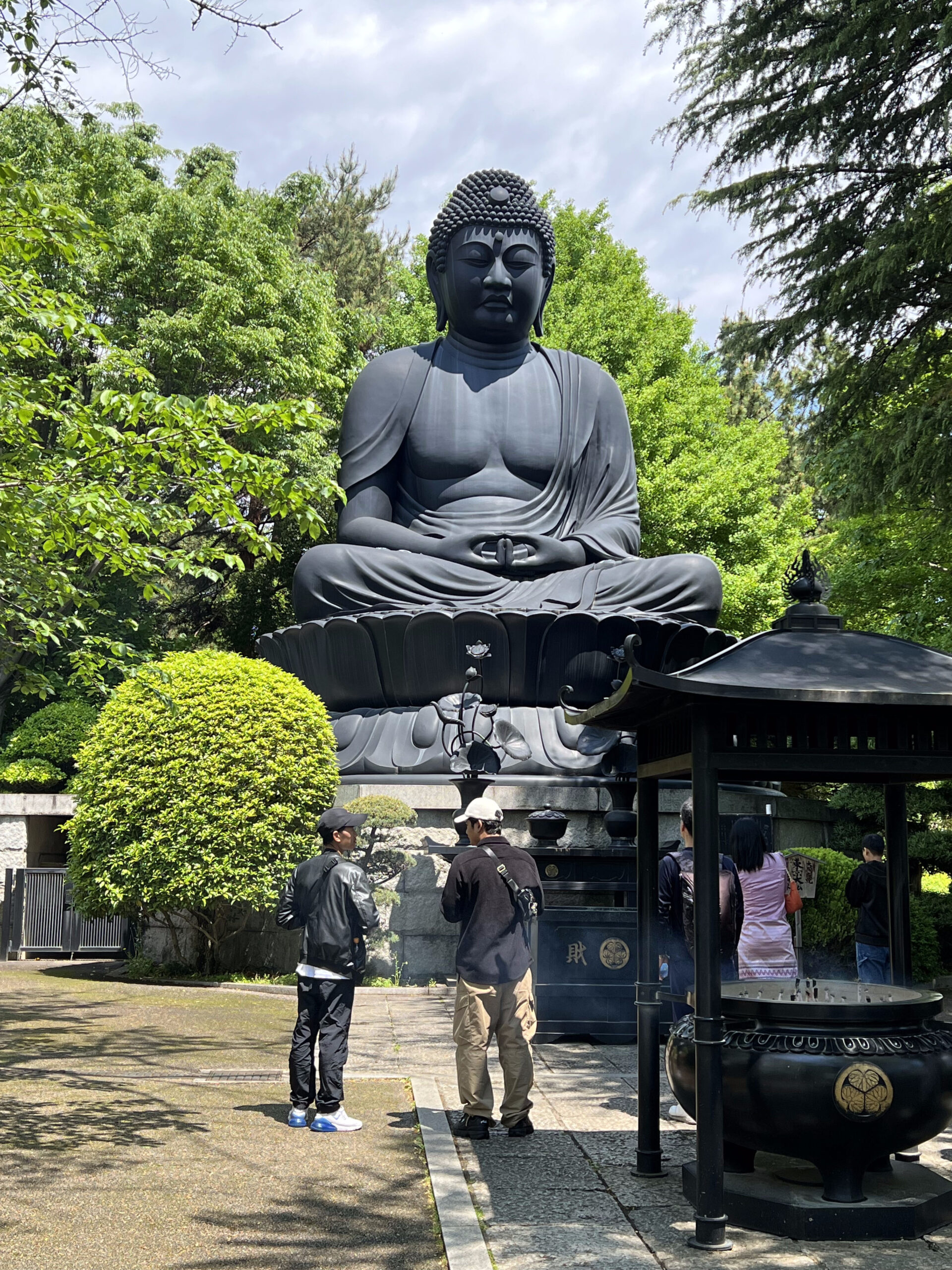
    Tokyo Daibutsu at Jōrenji
    Tokyo Daibutsu at Jōrenji. Photo: Asanagi / Wikimedia Commons / CC0.

    Fast facts

    • Admission: No standard fee for normal worship visits
    • Hours: Opens 9:00; last entry 15:45; closes 16:00
    • Address: 5-28-3 Akatsuka, Itabashi City, Tokyo
    • Nearest: Shimo-akatsuka Station, about 20 minutes on foot; or about 5 minutes from the Akatsuka 8-chōme bus stop
    • Time needed: About 45 to 60 minutes

    A giant Buddha with no tourist district around it

    The journey is part of the surprise. Jōrenji is not beside a bullet-train stop or packaged inside a famous temple town. From central Tokyo you travel into the northwestern suburbs, then take a local bus or walk through Akatsuka’s residential streets. The rooftops stay low. Vegetable plots and patches of older Tokyo appear between houses. Nothing announces that a figure as tall as a four-storey building is waiting ahead.

    Pass through Jōrenji’s gate, climb toward the main precinct and the Buddha finally rises above the courtyard. The setting makes the scale work. There is enough space to step back, but not so much that the statue becomes a distant landmark. You stand close enough to see the bronze surface, the folds of the robe and the calm expression looking over the temple grounds.

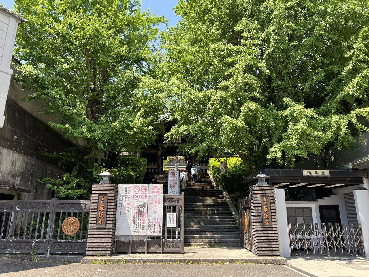
    Entrance to Jorenji temple in the quiet residential district of Akatsuka, Itabashi
    The entrance to Jōrenji in Akatsuka. Photo: Asanagi / Wikimedia Commons / CC0.

    It looks ancient. It was built in 1977.

    The Buddha’s stillness can make it feel centuries old, but Tokyo Daibutsu was completed in 1977. It is a bronze seated image of Amida Nyorai, the Buddha of Infinite Light central to Jōdo Buddhism. Measured from its base, the monument is 13 metres high; the head alone is about three metres. The bronze structure weighs approximately 32 tonnes.

    When completed, it was described as Japan’s third-largest seated bronze Buddha. Rankings have changed as newer statues have appeared, so the historical wording matters. Its significance was never simply a size competition.
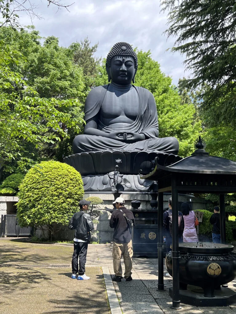
    Jōrenji’s 24th head priest, Wakabayashi Ryūdō, initiated the project after reflecting on the destruction of the 1923 Great Kantō Earthquake and the 1945 bombing of Tokyo. The statue was built as a prayer that the city would not again suffer such disaster and war. A monument that first appears to be a suburban curiosity is, in fact, a peace memorial.

    That origin gives the Buddha’s expression a different weight. It does not celebrate Tokyo’s power. It asks the city to remember how quickly streets, homes and lives can disappear.

    The temple is six centuries older than its famous statue

    Jōrenji traces its foundation to the Ōei era, between 1394 and 1428. The temple originally stood elsewhere in Itabashi and later became associated with the old Nakasendō post town. Tokugawa Ieyasu granted it land valued at ten koku in 1591, and later shoguns continued the grant. During falconry excursions, it served as a resting place for Tokugawa shoguns.

    The temple moved to the present Akatsuka site during the 1970s as road development transformed its former location. That relocation explains an unusual visual contradiction: a temple with medieval origins, Tokugawa connections and Edo stonework arranged around a monumental Buddha of postwar Japan.
    Meet the demon whose job is to endure

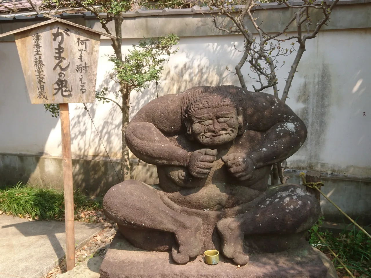
    Do not leave after photographing the Buddha. Among Jōrenji’s strangest objects is the Gaman no Oni—the “enduring ogre.” The crouching figure carries an immense stone burden while grimacing beneath its weight. Its popular name turns the usually threatening Japanese demon into a symbol of patience and endurance.

    The Gaman no Oni stone ogre carrying a heavy burden at Jorenji temple
    Gaman no Oni, the “enduring ogre.” Photo: 李桃桃内 / Wikimedia Commons / CC BY-SA 4.0.

    The ogre did not originate at Jōrenji. It belonged to a group of stone figures once kept at the Somei estate of the Tōdō family, lords of the Tsu domain, around present-day Komagome. Documents from 1818 depicted the collection, while an 1842 text already described the figures as unusually shaped curiosities.

    After passing through other hands, eight surviving figures were transferred to Jōrenji in 1967 and later moved with the temple to Akatsuka. They are rare not because nobody knows what an oni looks like, but because written records connect these exact eccentric sculptures to the private world of an Edo-period daimyō residence.

    The old woman waiting at the river of the dead

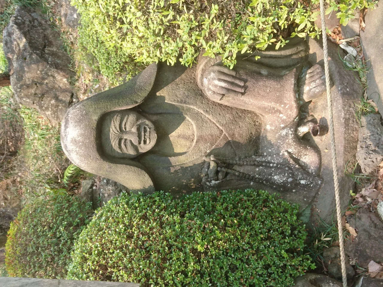
    Nearby sits an even stranger figure: Datsueba. In Japanese Buddhist folklore, this old woman waits beside the Sanzu River, the boundary between the living world and the afterlife. She strips the clothes from the dead, allowing their deeds to be judged by the weight of the garments.

    Stone statue of Datsueba, the old woman of the Buddhist underworld, at Jorenji
    Datsueba, once part of the Tōdō family’s Somei estate collection. Photo: 李桃桃内 / Wikimedia Commons / CC BY-SA 4.0.
    She is frightening, comic and oddly human at the same time—the opposite of the Buddha’s controlled symmetry. Together, the figures make Jōrenji feel less like a single-attraction temple and more like a compact museum of Japanese attitudes toward salvation, punishment, fear and persistence.

    Build a half-day around old Akatsuka

    The distance from the railway station is a feature, not a defect. Akatsuka sits on the edge of Tokyo’s Musashino uplands, where slopes, temple grounds, parks and remaining farmland break up the dense city. A slow approach allows the neighbourhood to establish the scale of the surprise.

    1. Start from Narimasu or Shimo-akatsuka. Walk if the weather is comfortable, or use the bus from Narimasu to Akatsuka 8-chōme.
    2. Enter Jōrenji before mid-afternoon. The final admission time is earlier than many Tokyo attractions.
    3. See the main hall before the Buddha. Let the temple reveal the giant statue gradually.
    4. Circle the grounds. Find Gaman no Oni, Datsueba and the other former Tōdō estate figures rather than leaving after one photograph.
    5. Continue to Akatsuka Botanical Garden or Itabashi Historical Museum. Both help turn a single temple visit into a quiet local half-day.

    If you want to follow Itabashi’s history toward the end of the samurai age, continue another day with our guide to Kondō Isami’s execution site and Shinsengumi memorial beside Itabashi Station.
    Before you go

    • Name: Jōrenji / Tokyo Daibutsu
    • Address: 5-28-3 Akatsuka, Itabashi-ku, Tokyo
    • Opening: 9:00 a.m.
    • Final entry: 3:45 p.m.
    • Complete closing: 4:00 p.m.
    • Admission: No standard admission fee for normal worship visits
    • Access: About 20 minutes on foot from Shimo-akatsuka Station; approximately five minutes on foot from the Akatsuka 8-chōme bus stop after taking a bus from Narimasu
    • Time needed: About 45–60 minutes inside the temple
    • Etiquette: Jōrenji is an active place of worship. Keep voices low, avoid photographing ceremonies or worshippers, and obey signs around restricted areas.

    Where this joins the rest of the east side

    Itabashi is the far end of the east side’s northern arc. On the way back, JR Itabashi Station has the grave of Kondo Isami and the Shinsengumi beside the ticket gates, and Akabane has the shrine with a bullet train underneath it. If a temple with a train is what you want, Nishiarai Daishi in Adachi has its own one-kilometer railway.

    Quick answers

    How big is the Tokyo Daibutsu?

    The seated bronze Amida at Jorenji is 13 meters high including its base, with a head about three meters tall, and weighs roughly 32 tonnes. When it was completed in 1977 it was described as Japan’s third-largest seated bronze Buddha.

    How do I get to Jorenji and the Tokyo Daibutsu?

    Jorenji is in Akatsuka, Itabashi City, in Tokyo’s north-west suburbs. Take the Tobu Tojo line to Shimo-Akatsuka or the Mita subway line to Nishi-Takashimadaira, then walk about 20 to 25 minutes or take a local bus; there is no station beside the temple.

    Is the Tokyo Daibutsu free to visit?

    Yes. Jorenji’s grounds and the Buddha are free and open during daytime hours. It is an active temple, so behave as you would at any place of worship.

    Why was the Tokyo Daibutsu built?

    The temple’s 24th head priest, Wakabayashi Ryudo, commissioned it in memory of the 1923 Great Kanto Earthquake and the 1945 bombing of Tokyo, as a prayer that the city would not suffer such disaster again. The temple itself dates from 1394-1428 and moved to Akatsuka in the 1970s.

    LOCAL SIDE JAPAN checked historical, opening and access information against Jōrenji, Itabashi City and the Itabashi Tourism Association on September 12, 2026. Opening times and access arrangements may change for New Year events, ceremonies or temple circumstances.

    Written by Kizuku. I run the Sunamachi Ginza Sumo Stable, a sumo experience in Koto City, and I write about the east side of Tokyo I live and work in. More about this site →

  • The Temple Where Yoshiwara’s Forgotten Women Were Buried

    The Temple Where Yoshiwara’s Forgotten Women Were Buried

    This article may contain affiliate links to booking sites. If you book through them, LOCAL SIDE JAPAN earns a small commission at no extra cost to you. How this site is made →

    HIDDEN HISTORY · MINOWA, TOKYO

    One minute from Minowa Station stands a temple with a brutal nickname: Nagekomi-dera, the “Throw-in Temple.” Behind that name are the women of Yoshiwara—workers sold into contracts, victims of fire, earthquake and disease, and people whose lives were often reduced to entertainment for someone else. Jōkanji is where Tokyo remembers them.

    Jokanji temple in Minamisenju, known for memorialising women of the Yoshiwara pleasure district
    Jōkanji in Minamisenju. Photo: Abasaa / Wikimedia Commons / Public domain.

    Fast facts

    • Admission: Free. No entrance fee for the publicly accessible areas; the grounds are open in daytime
    • Where: Minamisenju, Arakawa City, Tokyo, just north of the former Yoshiwara district
    • Nearest: Minowa Station (Hibiya line), about 1 minute on foot
    • Note: Some cemetery sections may be closed. Keep voices low and do not photograph mourners

    The temple outside Yoshiwara’s walls

    Jōkanji was founded in 1655, only two years before the licensed pleasure district moved from central Edo to Shin-Yoshiwara. The new district occupied what is now Senzoku in Taitō City. Jōkanji stood beyond its northern side, close enough to become inseparable from the lives and deaths inside.

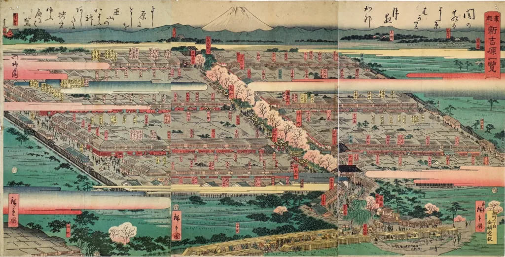
    Yoshiwara is often sold to modern audiences as a world of elaborate courtesan fashion, cherry blossoms and ukiyo-e beauty. It was also a controlled compound. A wall and moat separated it from surrounding fields, and entry was channelled through a principal gate. Many women had been sold into years of service through poverty and debt. Their movement was restricted, their earnings absorbed by contracts, and disease or fire could end a life long before freedom arrived.

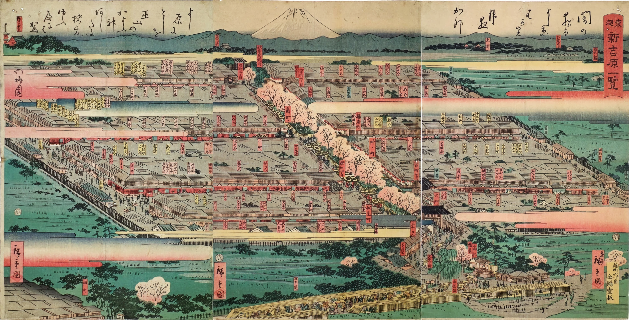
    View of Shin-Yoshiwara, July 1860, by Utagawa Hiroshige II. Collection of the Ota Memorial Museum of Art; via Wikimedia Commons / Public domain
    View of Shin-Yoshiwara, July 1860, by Utagawa Hiroshige II. Collection of the Ota Memorial Museum of Art; via Wikimedia Commons / Public domain.

    The print above is seductive from a distance: an orderly square floating among rice fields. Look again and its geometry becomes the story. Yoshiwara was not simply a colourful neighbourhood. It was a bounded commercial system in which female bodies, labour and time were tightly managed.

    Why was it called the “Throw-in Temple”?

    The nickname became associated with Jōkanji after the Ansei Edo earthquake of 1855. The disaster devastated Yoshiwara, and the bodies of women killed there were buried at the temple in a manner described by local history as resembling being “thrown in.” The phrase is shocking because the treatment was shocking.

    But the nickname can produce a false villain. Jōkanji was not the institution exploiting these women; it became a place that received and memorialised people whom the licensed district and wider society had left without secure family graves. The temple’s role was remembrance.

    Over the centuries, women and others connected with Yoshiwara continued to be buried here. A commonly cited estimate places the number at roughly 25,000, though it should be read as an estimate rather than a complete modern census. More concrete evidence survives in Jōkanji’s historical death registers, which record courtesans and their children across generations.

    “Born into suffering, dead at Jōkanji”

    The emotional centre of the grounds is the Shin-Yoshiwara Sōreitō, the collective memorial tower. Set into it is a line by the poet Hanamata Kasui:

    Umarete wa kugai, shishite wa Jōkanji.

    “Born into a world of suffering; dead, they came to Jōkanji.”

    Kugai literally evokes a sea or world of suffering, a Buddhist expression that also became inseparable from the hardship of women in licensed prostitution. The inscription refuses the glamorous Yoshiwara of souvenir imagery. It compresses an entire economic system into one life trajectory: hardship first, an anonymous temple burial last.

    Do not visit looking for a spectacle. The memorial contains no visual trick capable of representing thousands of individual lives. Its force comes from repetition—the knowledge that each name in a register once belonged to someone with habits, fears and plans beyond the identity assigned to her by a brothel.

    Yoshiwara survived into the age of photography

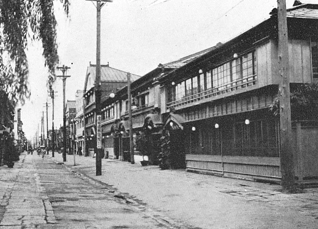
    The licensed district did not vanish with the shogunate. It was rebuilt after repeated fires and disasters, changed its legal form, and continued into the twentieth century. A photograph from 1932 shows a district more modern in architecture but still shaped by controlled sexual commerce.

    Historical photograph of Tokyo's Yoshiwara district in 1932
    Yoshiwara in August 1932. Unknown photographer, published in Rekishi Shashin; via Wikimedia Commons / Public domain.

    Japan’s Anti-Prostitution Law was enacted in 1956 and fully implemented in 1958, ending the licensed system. Yet the old map remains legible in present-day streets, and parts of the area continue as an adult-entertainment district. The historical Yoshiwara is therefore neither a vanished Edo fantasy nor a simple preserved attraction. It is a place where historical coercion, commercial nostalgia and current working lives overlap.

    The writer who asked to be buried here

    Novelist and essayist Nagai Kafū repeatedly visited Jōkanji. He spent much of his writing life walking Tokyo’s pleasure quarters and marginal neighbourhoods, recording the urban worlds that official modernisation preferred to erase.

    Kafū felt such attachment to the forgotten women memorialised here that he wished to be buried at Jōkanji. That request was not realised, but friends and admirers later established a poetry monument and a mound containing his writing brushes. The temple holds a memorial service for him, Kafū-ki, each year on April 30.

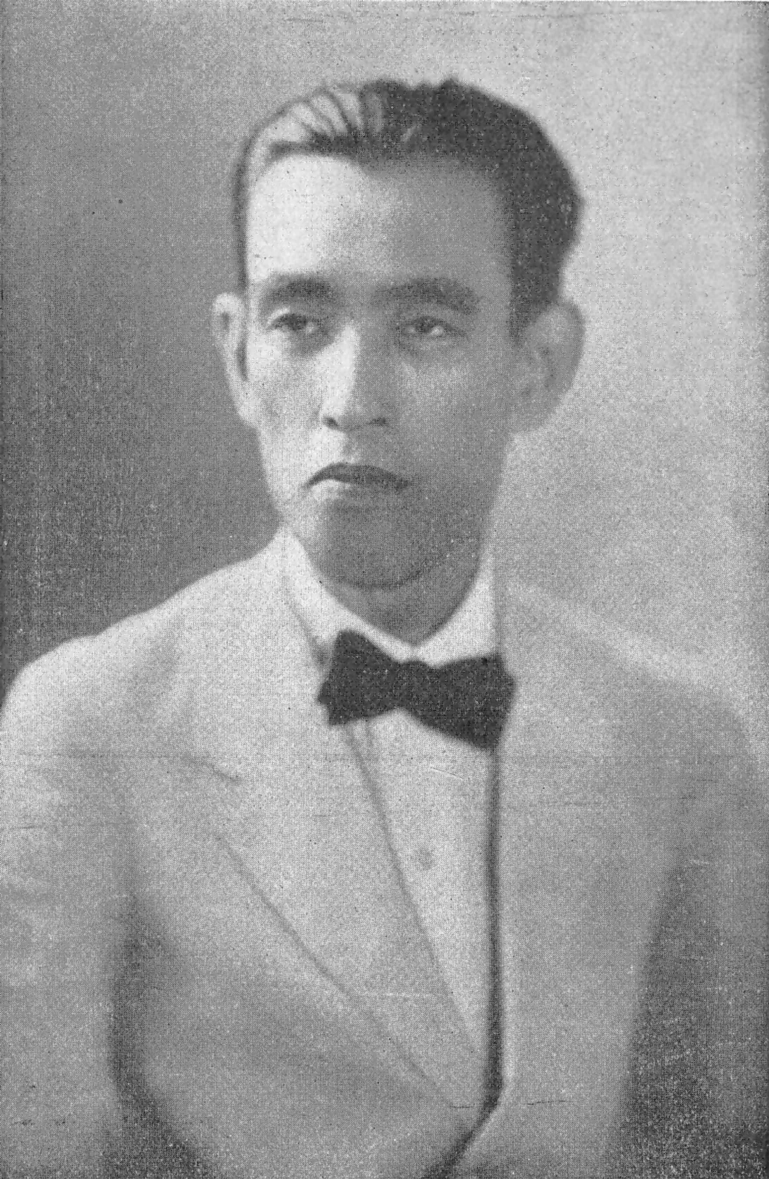
    Japanese writer Nagai Kafu, who repeatedly visited Jokanji temple
    Writer Nagai Kafū in 1927. Unknown photographer; via Wikimedia Commons / Public domain.

    His presence changes the tone of the site. Jōkanji is not only a cemetery of social history; it is also a place about who gets remembered in literature. Kafū recognised that the women excluded from respectable civic narratives were part of Tokyo’s story, not a footnote outside it.

    A respectful walk from Minowa to old Yoshiwara

    1. Begin at Tokyo Metro Minowa Station. Jōkanji is about one minute away, before the modern city has time to become scenic.
    2. Visit the main temple area first. Read the signs and remember that some cultural properties or cemetery sections may not always be open.
    3. Pay respects at the Shin-Yoshiwara collective memorial. Avoid posed or “haunted Tokyo” photography.
    4. Look for the Kafū monuments. They connect the cemetery to the literature of Tokyo’s disappearing backstreets.
    5. Walk south toward the former Yoshiwara. The old district’s rectangular outline can still be sensed in the street pattern; the former Great Gate area and Mikaeri Yanagi mark the historic approach.

    Be especially careful with photography after leaving the temple. The former Yoshiwara remains a working adult-entertainment area. Do not photograph workers, customers, entrances, private businesses or local residents without clear permission. History does not cancel anyone’s present-day privacy.

    Jōkanji also fits naturally into a deeper walk through northern Edo’s buried boundary. Continue to the nearby Kozukappara execution ground and Kubikiri Jizō, where another quiet temple landscape preserves people excluded from ordinary records.

    Before you go

    • Name: Jōkanji (浄閑寺), also known as Nagekomi-dera
    • Address: 2-1-12 Minamisenju, Arakawa-ku, Tokyo
    • Nearest station: Tokyo Metro Hibiya Line, Minowa Station
    • Walking time: About one minute from Minowa Station; about five minutes from Minowabashi on the Tokyo Sakura Tram
    • Suggested visit: About 20–30 minutes at the temple; 60–90 minutes with a respectful walk toward former Yoshiwara
    • Closing time: 4:30 p.m. from December through February; 5:00 p.m. from March through November
    • Admission: No standard entrance fee for publicly accessible areas
    • Etiquette: Keep voices low, do not enter closed sections, and never treat graves as horror-film props

    Related: Kappabashi, fifteen minutes south: how to buy a Japanese knife without getting it wrong.

    Related: Yanaka on a weekday: the free loop from Nippori to Nezu.


    Where this joins the rest of the east side

    Jokanji sits between two of the east side’s darker sites: the Kozukappara execution ground is a ten-minute walk away at Minamisenju, and the Yoshiwara quarter itself is fifteen minutes south, on the way to Asakusa. North across the Senju Ohashi is Kita-Senju, the old post town where the highway out of Edo began.

    Quick answers

    Where is Jokanji temple?

    In Minamisenju, Arakawa City, about one minute from Minowa Station on the Hibiya subway line, just north of the former Yoshiwara district in Taito City. The grounds are free and open in daytime.

    Why is Jokanji called the Throw-in Temple?

    The nickname Nagekomi-dera dates from the Ansei earthquake of 1855, when the bodies of Yoshiwara women killed in the disaster were buried at the temple in a manner local history describes as ‘thrown in’. The temple received and memorialized women whom the licensed district left without family graves.

    How many Yoshiwara women are buried at Jokanji?

    A commonly cited estimate is around 25,000 over the centuries, based on the temple’s death registers, which record courtesans and their children across generations. The figure is an estimate rather than a modern count.

    Can visitors go inside Jokanji?

    The grounds, the Shin-Yoshiwara memorial tower and the Nagai Kafu monument are open to visitors. It is an active temple and a burial ground: no tripods, quiet voices, and a small bow at the memorial are appropriate.

    LOCAL SIDE JAPAN checked historical, location and access information against Jōkanji and Arakawa City materials on September 12, 2026. The often-repeated total of roughly 25,000 burials is presented as an estimate. Opening conditions may change for ceremonies, maintenance or temple circumstances.

    Written by Kizuku. I run the Sunamachi Ginza Sumo Stable, a sumo experience in Koto City, and I write about the east side of Tokyo I live and work in. More about this site →

  • Tokyo Executed a Samurai Legend Beside This Station.

    Tokyo Executed a Samurai Legend Beside This Station.

    This article may contain affiliate links to booking sites. If you book through them, LOCAL SIDE JAPAN earns a small commission at no extra cost to you. How this site is made →

    HIDDEN HISTORY · ITABASHI, TOKYO

    Leave JR Itabashi Station by the east exit and you are immediately surrounded by the practical Tokyo of ticket gates, bicycles and apartment buildings. Yet only a few steps away stands a small cemetery for Kondō Isami and the Shinsengumi. Somewhere within this ordinary station landscape, the commander of Japan’s most famous samurai police force spent his final hours.

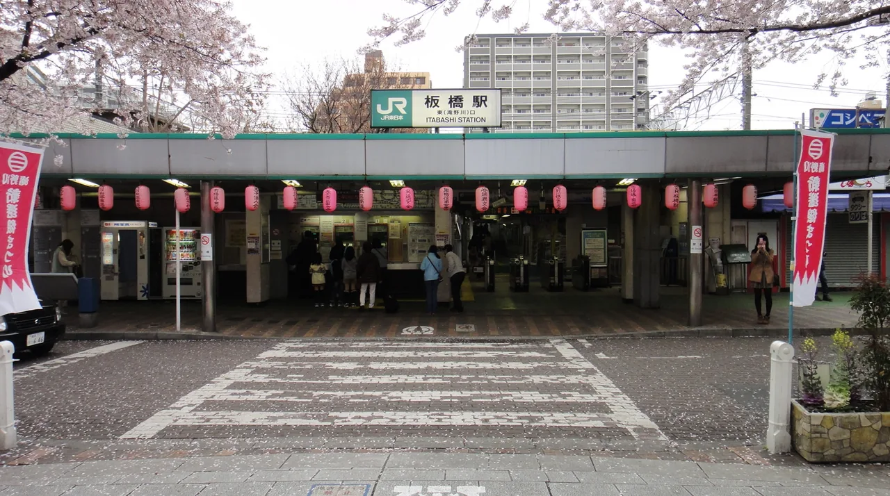
    The east entrance of JR Itabashi Station near the execution site and memorial of Kondo Isami
    Itabashi Station’s east entrance, a short walk from the memorial. Photo: DAJF / Wikimedia Commons / CC BY-SA 3.0.

    Fast facts

    • Admission: Free
    • Where: The detached cemetery of Jutokuji, beside the east (Takinogawa) exit of JR Itabashi Station. Technically in Kita City
    • Nearest: JR Itabashi Station (Saikyō line), a few steps from the east exit
    • Note: The cemetery is close to, not on, the exact location of the execution ground

    The station exit that opens onto the end of the samurai age

    Itabashi is not where most visitors go looking for the Shinsengumi. The group is usually associated with Kyoto: pale-blue haori coats, the Ikedaya Incident and sword fights in the final years of the Tokugawa shogunate. But the story of its commander ends here, on what was then the northern approach to Edo.

    In 1868, the old political order was collapsing into the Boshin War. After defeat at Toba–Fushimi, Kondō and surviving allies continued resisting the new imperial government. He reorganised his men as the Kōyō Chinbutai and later established a position at Nagareyama, northeast of Tokyo. There he was captured—or surrendered, depending on how the episode is framed—and taken to the new government army’s headquarters at Itabashi-juku.

    Kondō had used the name Ōkubo Yamato, but former opponents identified him. On the 25th day of the fourth month of Keiō 4—May 17, 1868 in the modern calendar—he was executed near the old Hirawo milestone. He was 33 by Western age counting, although Japanese sources traditionally describe him as 35 by the historical kazoedoshi system.

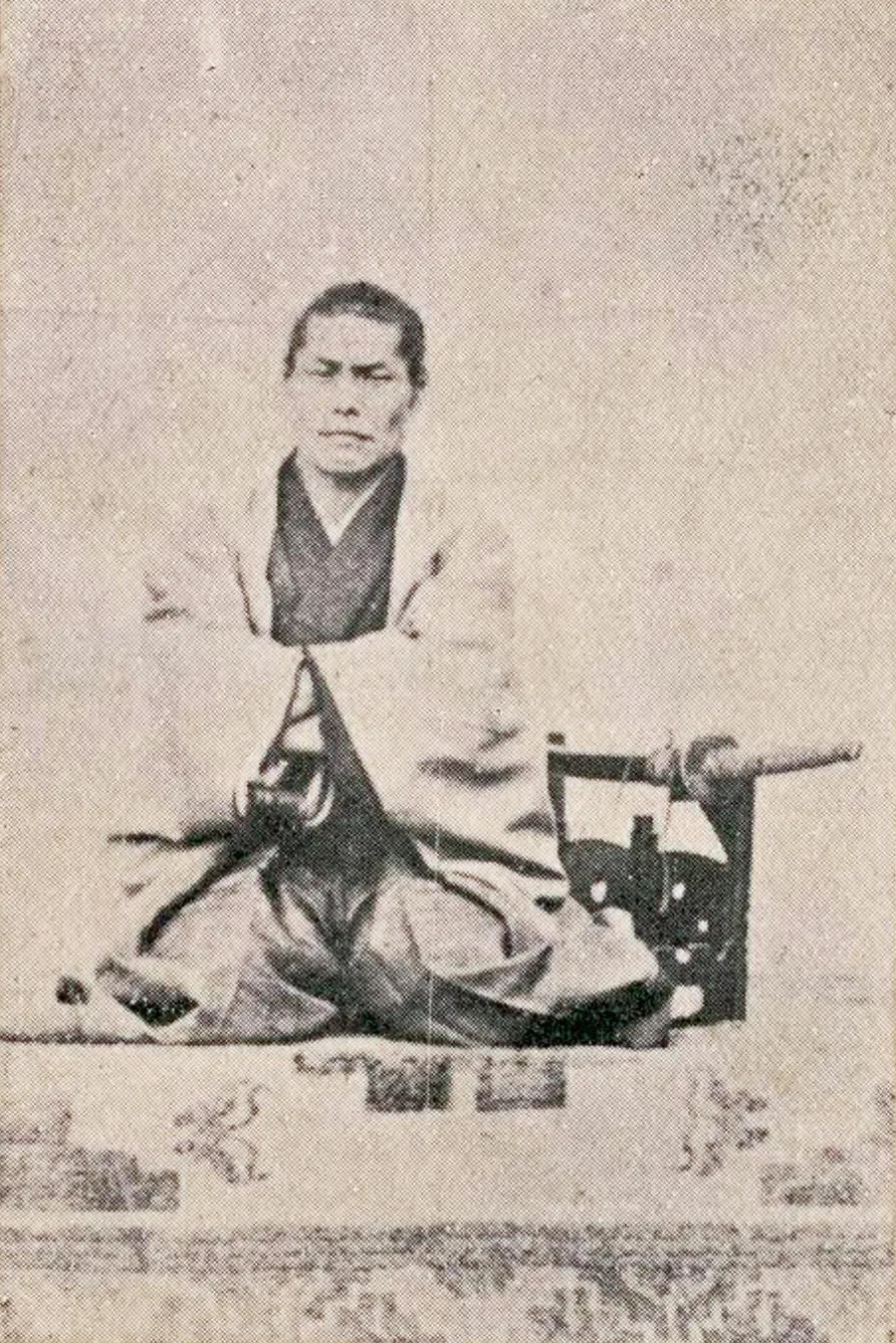
    Historical portrait of Shinsengumi commander Kondo Isami
    Kondō Isami (1834–1868). Source: National Diet Library Digital Collections via Wikimedia Commons / Public domain.

    There is no preserved execution ground

    Visitors expecting a fenced historical site will not find one. Roads, railway facilities and later construction transformed the ground. A stone marker identifies the former Itabashi execution site, but the surrounding city gives no visual warning about what happened here.

    This distinction matters: the cemetery beside the station is close to the execution site, not a perfectly preserved patch of the scaffold itself. Even the old place-name can confuse modern travellers. The memorial stands in today’s Kita City, although it is beside Itabashi Station and historically connected with Itabashi-juku.

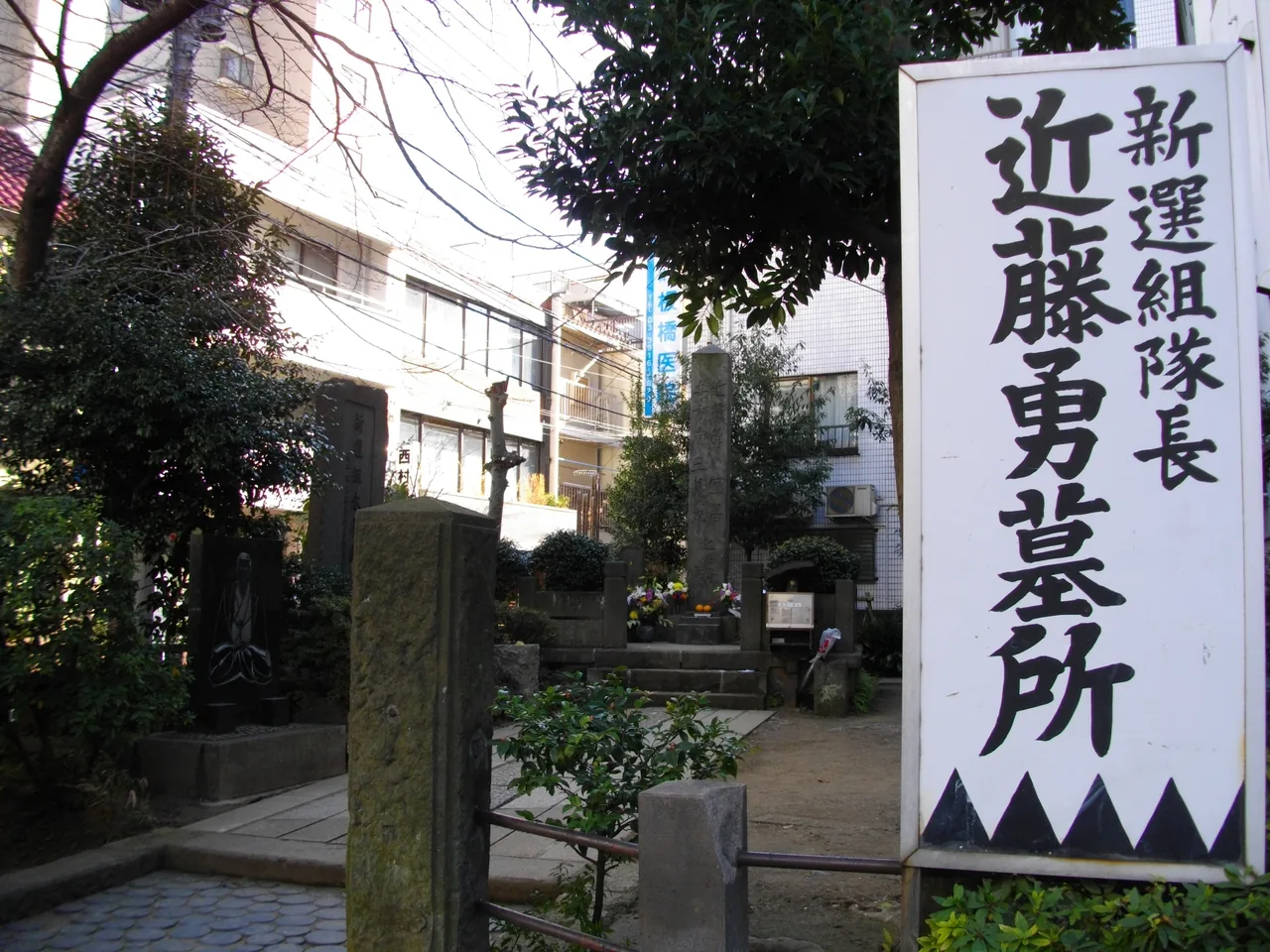
    Stone sign marking the former Itabashi execution grounds near JR Itabashi Station
    Marker for the former Itabashi execution grounds. Photo: Abasaa / Wikimedia Commons / Public domain.

    The lack of scenery is precisely what makes the place powerful. A visitor can arrive without ceremony, cross from the station and suddenly face the violent transfer of power that created modern Japan. The distance between “history” and “Tuesday morning commute” is only a few metres.

    A grave built by the comrade who survived

    The present memorial was not waiting here when Kondō died. It was erected in 1876, eight years after the execution, through the efforts of former Shinsengumi member Nagakura Shinpachi, with support from Matsumoto Ryōjun, a doctor who had served the shogunate.

    The monument commemorates Kondō, vice-commander Hijikata Toshizō and other members of the Shinsengumi. The names of 110 people connected with the force are carved on its sides. That makes it more than the grave of one famous swordsman: it is among the earliest memorials created specifically for the Shinsengumi.

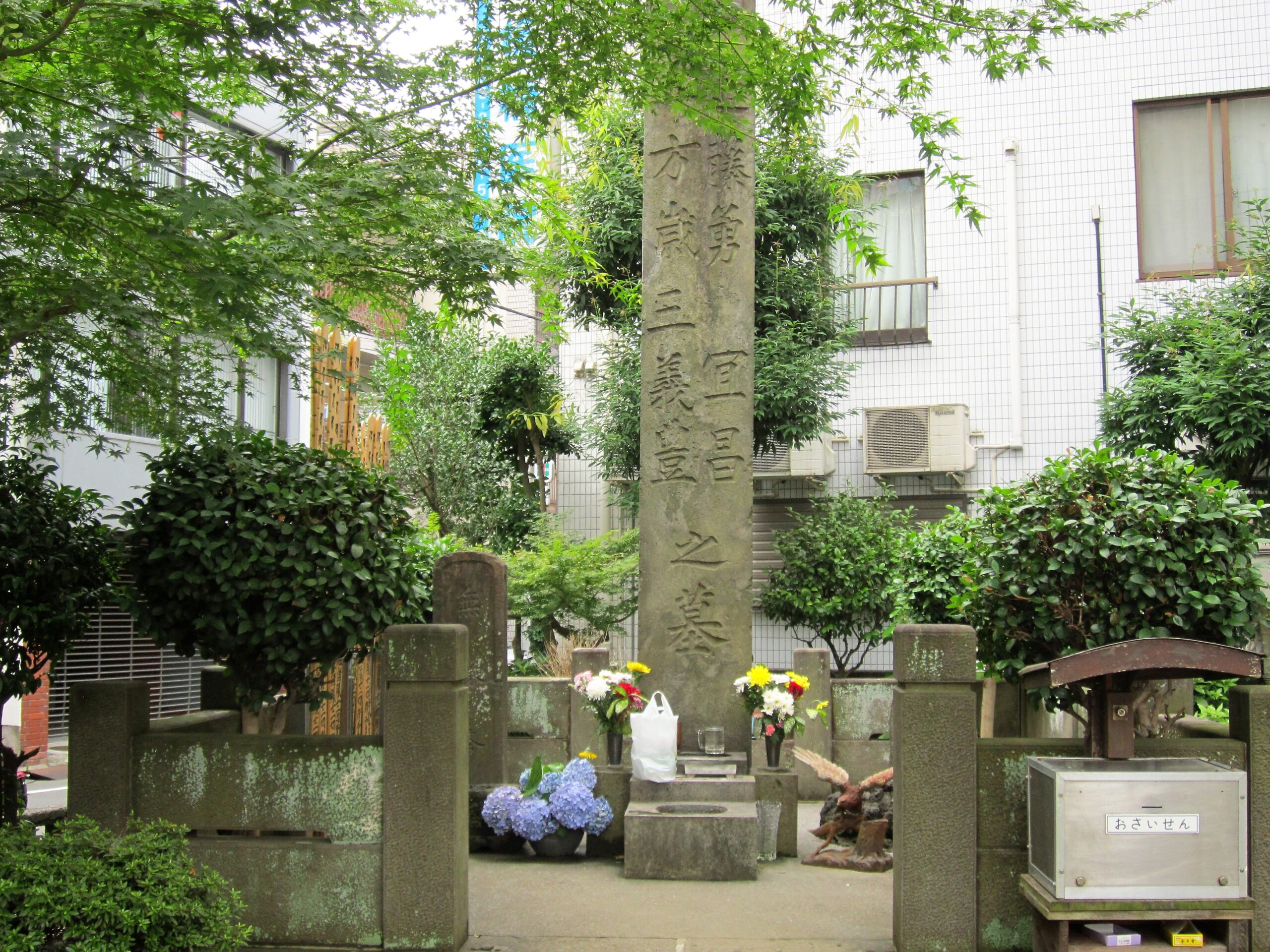
    The Kondō Isami and Shinsengumi memorial at the detached cemetery of Jutokuji
    The Kondō Isami and Shinsengumi memorial at the detached cemetery of Jutokuji. Photo: Suikotei / Wikimedia Commons / CC BY-SA 4.0.

    Calling it simply “Kondō’s grave” also hides a complicated story. Kita City’s official account says his head was displayed at Sanjō riverbank in Kyoto and his torso was buried in an unmarked mound at Takinogawa. Other locations in Japan maintain their own Kondō burial traditions. The Itabashi site is therefore best understood as both a grave and a collective memorial—a place where survivors and later admirers gave the defeated a name again.

    Who was Kondō Isami?

    Kondō was not born into the elite rank suggested by later samurai legend. Born Miyagawa Katsugorō in 1834 to a farming family in Tama, west of Edo, he entered the Tennen Rishin-ryū school of swordsmanship, was adopted into its Kondō line and eventually led the Shieikan dojo.

    In 1863, he travelled to Kyoto with the group that became the Shinsengumi. Officially charged with maintaining order, its members defended the Tokugawa side in an increasingly fractured capital. To supporters they were disciplined loyalists. To enemies they were a feared political police force. Popular culture turned them into romantic heroes, but their real history includes factional killings, rigid internal rules and lethal street violence.

    Itabashi strips away the costume-drama glamour. Kondō did not fall during a cinematic sword duel. He was a prisoner of a new government, executed in public as the shogunate he served disappeared. Within months, Edo itself would be renamed Tokyo.

    The strange afterlife of “the god of fever”

    Local tradition gives the site an unexpected second life. According to an account preserved by Kita City, a woman opened a shop without knowing that it stood on the former execution ground. When she developed recurring fever or chills—called okori—a local elder advised her to pray at Kondō’s grave. She recovered, the story says, and Kondō gained a folk reputation as an okori no kamisama, a deity who could relieve the illness.

    This is folklore, not medical advice and not a verified supernatural event. But it shows how communities metabolise difficult places. An executed enemy of the state became a memorialised commander, then a neighbourhood guardian. Tokyo did not preserve the scaffold; it preserved a relationship with the dead.

    How to visit without turning it into a costume set

    1. Exit JR Itabashi Station on the east, or Takinogawa, side. The cemetery is almost immediately visible.
    2. Read the historical signs before photographing. They clarify the relationship between the memorial, the station and the former execution site.
    3. Look around the entire monument. The inscriptions for other Shinsengumi members are essential to understanding it as a collective memorial.
    4. Continue toward old Itabashi-juku. A walk along the former Nakasendō road helps restore the geography that modern railways have obscured.

    Keep voices low and do not lean equipment against graves. The location may be famous among Shinsengumi fans, but it remains the detached cemetery of Jutokuji and an active place of remembrance.

    For another Tokyo site where railway lines sit against the memory of state execution, read our guide to the Kozukappara execution ground in Minamisenju. The two places reveal opposite ends of Edo—and how modern Tokyo absorbed both into ordinary neighbourhoods.

    Where can you actually hold a sword?

    Somewhere else. This is a working cemetery with a stone in it, and twenty minutes here is the whole visit. If part of what brought you to Kondō Isami is the sword itself, it is worth knowing what the city actually sells under that heading, because the gap between the options is wide.

    The Shinsengumi and samurai attractions around Asakusa and Shinjuku are costume and photography: you are given hakama, a blunt alloy replica and a photographer. Nothing is wrong with that, but the listings do not always say that the blade is not sharp and there is no tatami-mat cutting, which is the one thing most people picture. If that is what you were expecting, you will be disappointed at the door.

    The nearer thing to what Kondō did for a living is a dojo. A two-hour kendo session in a real dojo in Arakawa City, armour and shinai provided, ends in a mock tournament and runs about ¥18,000; an hour of Mugai-ryū iaido in Kuramae — drawing the sword, which is the discipline people mean when they picture a samurai — is about ¥23,000 with a named school and an English-speaking instructor. Both are east-side, both are an order of experience away from posing. The four things Tokyo sells as a samurai experience, and what each one is →

    Do the dojo on a different day from this one. Walking out of a cemetery and into a costume hour in the same afternoon is the thing the section above is asking you not to do.

    Before you go

    • Official name: Grave of Kondō Isami and Shinsengumi members
    • Location: Detached cemetery of Jutokuji, 7-8-10 Takinogawa, Kita-ku, Tokyo
    • Nearest station: JR Itabashi Station, East/Takinogawa Exit
    • Walking time: About one minute from the station exit
    • Suggested visit: 20–30 minutes for the memorial; 60–90 minutes if combined with old Itabashi-juku
    • Best time: Daylight hours
    • Annual remembrance: A memorial service is generally held around April 25, with a local Shinsengumi festival held in spring; confirm the year’s dates before travelling
    • Etiquette: Treat the grounds as a cemetery, not a film location. Do not enter closed sections or photograph mourners without permission.

    Where this joins the rest of the east side

    The end of the shogunate is scattered across the north of the east side: Yoshida Shoin and other Ansei Purge victims lie at Ekoin beside the Kozukappara execution ground in Minamisenju. Two stops north of Itabashi, Akabane Hachiman has a Shinkansen under it; one stop south, Oji has the foxes.

    Quick answers

    Where is Kondo Isami’s grave?

    Beside the east exit of JR Itabashi Station (Saikyo line), in the detached cemetery of Jutokuji. The memorial is technically in Kita City, a few steps from the station. It is free and open.

    When and why was Kondo Isami executed?

    On May 17, 1868, during the Boshin War, after he was captured at Nagareyama and identified by former opponents at the new government’s Itabashi headquarters. He was 33. His head was displayed in Kyoto; the Itabashi memorial is both a grave and a collective monument.

    Who built the Kondo Isami memorial?

    Former Shinsengumi member Nagakura Shinpachi, with the doctor Matsumoto Ryojun, erected it in 1876. It commemorates Kondo, Hijikata Toshizo and 110 people connected with the Shinsengumi, and is among the earliest memorials to the group.

    Is the Itabashi execution ground preserved?

    No. A stone marker identifies the former site, but roads and railway works transformed the ground. The cemetery beside the station is close to, not on, the scaffold’s exact location.

    LOCAL SIDE JAPAN checked location and historical information against official materials from Itabashi City, Kita City and the Tokyo Metropolitan Government on September 12, 2026. Historical accounts differ over the location and contents of Kondō Isami’s burials; the article distinguishes the locally documented memorial from broader burial traditions.

    Written by Kizuku. I run the Sunamachi Ginza Sumo Stable, a sumo experience in Koto City, and I write about the east side of Tokyo I live and work in. More about this site →

  • Tokyo’s Old Execution Ground Hides Beside a Train Station.

    Tokyo’s Old Execution Ground Hides Beside a Train Station.

    This article may contain affiliate links to booking sites. If you book through them, LOCAL SIDE JAPAN earns a small commission at no extra cost to you. How this site is made →

    HIDDEN HISTORY · MINAMISENJU, TOKYO

    Step out of Minamisenju Station and Tokyo looks entirely ordinary: railway tracks, apartment blocks, bicycles and convenience stores. Then, a few minutes away, you meet a stone Buddha nearly four metres tall. It stands beside the remains of one of Edo’s principal execution grounds—and the place where a grim encounter helped change Japanese medicine.

    Kubikiri Jizo at the former Kozukappara execution ground
    Kubikiri Jizo at the former Kozukappara execution ground. Photo: Nesnad / Wikimedia Commons / CC BY-SA 4.0.

    A place Tokyo did not erase—only build around

    The name is Kozukappara, sometimes written Kozukahara. During the Edo period, this northern edge of the city was used as an execution ground, while Suzugamori served a similar role on Edo’s southern approach. Punishment here was deliberately public: the location stood near a major road into the capital, turning state power into something travellers could see.

    Local history describes a site of roughly 2,000 tsubo—about 6,600 square metres—that continued operating until July 1873. You may see claims that more than 200,000 people died here. That figure is repeated in local accounts, but surviving records are incomplete, so it is better understood as a traditional estimate than a precise count.

    Modern infrastructure cut through the former grounds. Railway construction altered the landscape, and the great stone figure was moved from its earlier position south of the freight line. That is what makes the area so unsettling today. There is no dramatic ruin and no theatrical entrance. The city simply continued—tracks beside graves, homes beside memorials, commuters passing a place of punishment without necessarily knowing its name.

    Enmeiji temple beside the former Kozukappara execution ground in Minamisenju
    Enmeiji in Minamisenju. Photo: Abasaa / Wikimedia Commons / Public domain.

    The “Beheading Jizo” was built for mercy, not execution

    The most visible survivor is at Enmeiji: Kubikiri Jizo, usually translated as “Beheading Jizo.” The nickname easily creates the wrong impression. The statue was not an instrument of punishment. It was erected in 1741 to console those who had been executed and those who died without anyone to tend their graves.

    Almost four metres high and assembled from 27 pieces of granite, the seated figure has a physical weight that photographs barely communicate. It does not look toward a scenic garden. Railway steel, utility wires and the compact geometry of the neighbourhood surround it. That collision—compassion carved in stone, framed by everyday transport—is the real image of Kozukappara.

    Pause here rather than treating it as a checklist stop. Enmeiji is a working Buddhist temple and this is a memorial to real people, many of whose names are gone. Quiet voices, discreet photography and a small bow are more appropriate than ghost-hunting poses.

    The execution ground that opened an anatomy book

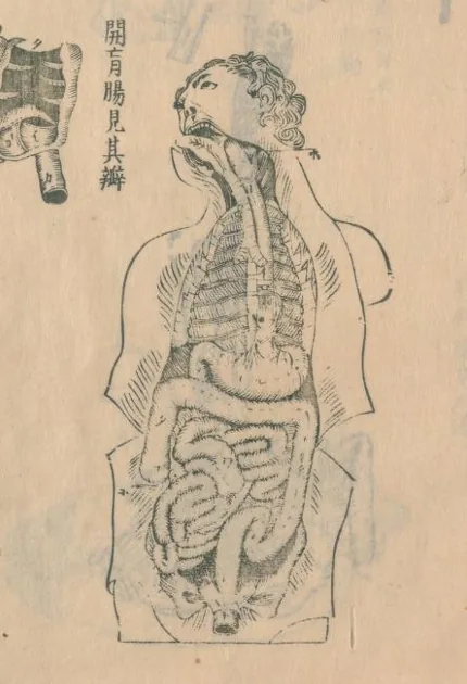
    Kozukappara also holds an extraordinary place in the history of Japanese medicine. In 1771, physicians including Sugita Genpaku, Maeno Ryotaku and Nakagawa Jun’an attended the dissection of an executed person here. They brought a Dutch anatomy book—commonly known in Japan as Tafel Anatomia—and compared its illustrations with the body before them.

    The accuracy of the European anatomical images convinced them that the text had to be translated. The task was formidable: their command of Dutch was limited, specialist dictionaries were scarce and the medical vocabulary they needed often did not yet exist in Japanese. Their work eventually produced Kaitai Shinsho in 1774, a landmark Japanese translation of Western anatomy.

    An anatomical illustration from the eighteenth-century Japanese medical work Kaitai Shinsho
    A page from Kaitai Shinsho. Source: National Diet Library Digital Collections via Wikimedia Commons / Public domain.

    The story should not be polished into an uncomplicated tale of scientific progress. New knowledge came through the body of a person killed by the state, whose identity is often omitted when the episode is retold. Kozukappara forces those two histories—medicine and punishment—into the same frame.

    Ekoin: graves, remembrance and the Kanzo memorial

    On the other side of this fragmented historical landscape is Ekoin. The temple was established here in 1667 by the better-known Ekoin in Ryogoku to pray for prisoners who died in jail and people executed at Kozukappara.

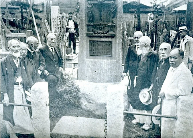
    Its grounds contain graves connected with the political upheavals at the end of the Tokugawa shogunate, including those of Yoshida Shoin and Hashimoto Sanai, both executed during the Ansei Purge. Near the main hall stands the Kanzo memorial, commemorating the 1771 dissection witnessed by Genpaku and his colleagues.

    The 1922 unveiling of the Kanzo memorial at Ekoin temple in Minamisenju
    The Kanzo memorial unveiling at Ekoin in 1922. Unknown photographer, originally published in Rekishi Shashin; via Wikimedia Commons / Public domain.

    Do not assume every cultural property is always accessible. Ekoin remains an active religious site, some objects are not normally open to the public, and ceremonies take priority. The reward is not a collection of spectacular objects. It is the rare sensation of standing where several versions of Japanese history overlap: criminal justice, Buddhism, political dissent, translation and medicine.

    A one-hour walk through the buried edge of Edo

    1. Start at Minamisenju Station. The JR Joban Line, Tokyo Metro Hibiya Line and Tsukuba Express all stop here.
    2. Walk to Enmeiji. Find Kubikiri Jizo and notice how tightly the temple, road and railway occupy the former execution-ground landscape.
    3. Continue to Ekoin. Look for the Kanzo memorial and the registered graves that are accessible without entering restricted areas.
    4. Finish by walking the ordinary streets. The absence of a preserved “historic district” is part of the story: modern Minamisenju grew directly across the old boundary of Edo.

    If you want to continue deeper into eastern Tokyo, pair this visit with the extraordinary disaster-planning architecture of the Shirahige-Higashi firewall apartments. Together, the two places show how Tokyo hides difficult history inside structures that still serve daily life.

    Before you go

    • Area: Minamisenju, Arakawa City, Tokyo
    • Nearest station: Minamisenju Station
    • Enmeiji: 2-34-5 Minamisenju, Arakawa-ku, Tokyo
    • Ekoin: 5-33-13 Minamisenju, Arakawa-ku, Tokyo
    • Time needed: About 45–75 minutes for both temples and the surrounding streets
    • Best time: Daylight hours; avoid arriving near closing time
    • Cost: No standard admission fee for the publicly accessible grounds; do not enter closed or private areas
    • Etiquette: These are active temples and memorial spaces. Keep voices low, do not photograph worshippers or ceremonies without permission, and never stage “scary” photos beside graves.

    Related: Kappabashi, fifteen minutes south: how to buy a Japanese knife without getting it wrong.

    Related: Yanaka on a weekday: the free loop from Nippori to Nezu.


    Where this joins the rest of the east side

    Ten minutes’ walk away is Jokanji, where the women of Yoshiwara were buried. Across the Senju Ohashi to the north is Kita-Senju, the first post town on the road these condemned prisoners were paraded along. The other Shinsengumi-era grave on the east side is Kondo Isami’s at Itabashi.

    Quick answers

    Where is the Kozukappara execution ground?

    In Minamisenju, Arakawa City, a few minutes from Minamisenju Station (Hibiya line, Tsukuba Express, JR Joban line). The main surviving landmarks are the Kubikiri Jizo at Enmeiji beside the tracks and Ekoin temple across the road. Both are free.

    How many people were executed at Kozukappara?

    Local accounts repeat a figure of over 200,000 between the 1600s and 1873, but surviving records are incomplete and the number is a traditional estimate rather than a count. The site was about 6,600 square meters.

    What is the Kubikiri Jizo?

    A seated stone Jizo almost four meters high, assembled from 27 granite pieces, erected at Enmeiji in 1741 to console the executed and the unclaimed dead. Despite the nickname ‘Beheading Jizo’ it was built for mercy, not punishment.

    What happened at Kozukappara in 1771?

    Physicians Sugita Genpaku, Maeno Ryotaku and Nakagawa Jun’an watched the dissection of an executed person here and compared it with a Dutch anatomy book. The accuracy convinced them to translate it, producing Kaitai Shinsho in 1774, a landmark of Japanese medicine.

    LOCAL SIDE JAPAN checked historical and access information against Arakawa City materials on September 12, 2026. Temple access and visible areas can change for ceremonies, maintenance or local circumstances. Historical totals for executions are estimates and are identified as such above.

    Written by Kizuku. I run the Sunamachi Ginza Sumo Stable, a sumo experience in Koto City, and I write about the east side of Tokyo I live and work in. More about this site →

  • Tokyo Built a 1.2-Kilometer Apartment Wall to Stop Fire.

    Tokyo Built a 1.2-Kilometer Apartment Wall to Stop Fire.

    This article may contain affiliate links to booking sites. If you book through them, LOCAL SIDE JAPAN earns a small commission at no extra cost to you. How this site is made →

    TOKYO / SUMIDA / DISASTER ARCHITECTURE

    Tokyo built a 1.2-kilometer wall to stop the city from burning.

    Then it put nearly 1,900 apartments inside it.

    Along a quiet road in northern Sumida, 18 connected residential blocks stretch beside the Sumida River. Families live here. Children go to school here. There are shops, a nursery and bicycles parked below the balconies.

    But look closer. Steel shutters hang between the buildings. Water cannons point toward the street. Unusually deep balconies form defensive ledges. Emergency gates can seal the openings.

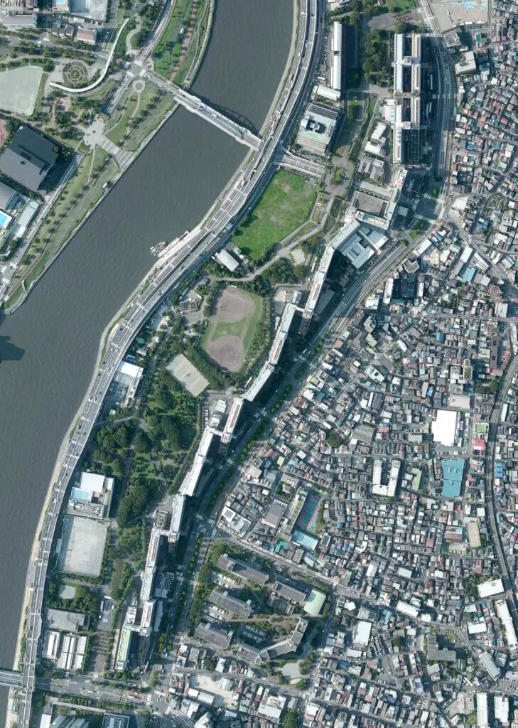
    This is the Shirahige-Higashi apartment complex: a residential neighborhood designed to transform into a giant firewall when Tokyo burns.

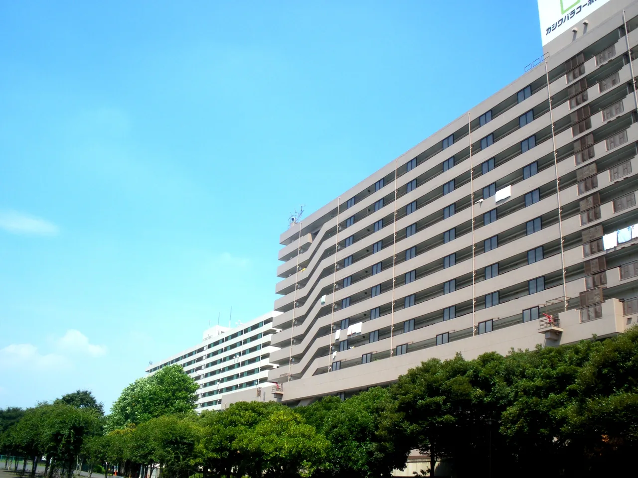
    The long connected Shirahige-Higashi apartment blocks in Sumida Tokyo
    A section of the connected residential wall in Sumida. Photo: Kamemaru2000 / Wikimedia Commons, CC BY-SA 3.0.

    The apartments are supposed to become a wall

    From a distance, Shirahige-Higashi looks like an exceptionally long piece of 1980s public housing.

    That is accurate, but incomplete.

    The buildings stand about 40 meters high and continue for roughly 1.2 kilometers. They were positioned between an area once crowded with wooden houses and the open evacuation ground of Higashi-Shirahige Park.

    If a major earthquake starts fires in the surrounding streets, the complex is meant to shield people gathering in the park from flames, radiant heat and burning debris carried by the wind.

    Residents do not evacuate from the firewall.

    They live inside it.

    Why eastern Tokyo feared fire

    Tokyo’s disaster planning cannot be understood by thinking only about buildings collapsing.

    The city has repeatedly been destroyed by fire.

    After the 1923 Great Kanto Earthquake, tens of thousands of people fled to the open ground of the former Army Clothing Depot in what is now Sumida. They believed the empty site would protect them. Instead, fire approached from several directions. A fire whirl swept through the crowd, producing the earthquake’s deadliest single tragedy.

    Later, the 1945 firebombing again demonstrated how rapidly flames could move through Tokyo’s tightly packed wooden neighborhoods.

    The lesson was brutal: an open evacuation space is not safe if heat and fire can enter it.

    A Cold War-scale plan for an urban fire

    In 1969, the Tokyo Metropolitan Government developed a plan for six large disaster-prevention bases across the low-lying Koto Delta.

    The concept was larger than building a few evacuation parks. Each base would combine open refuge space with fire-resistant redevelopment around its edges.

    Shirahige-Higashi was considered one of the delta’s most vulnerable districts and became the model project. Planning was approved in 1972. Residents began moving into the completed apartment complex in 1982, and the adjacent metropolitan park opened in 1986.

    The result feels less like normal urban planning and more like a machine built at neighborhood scale.

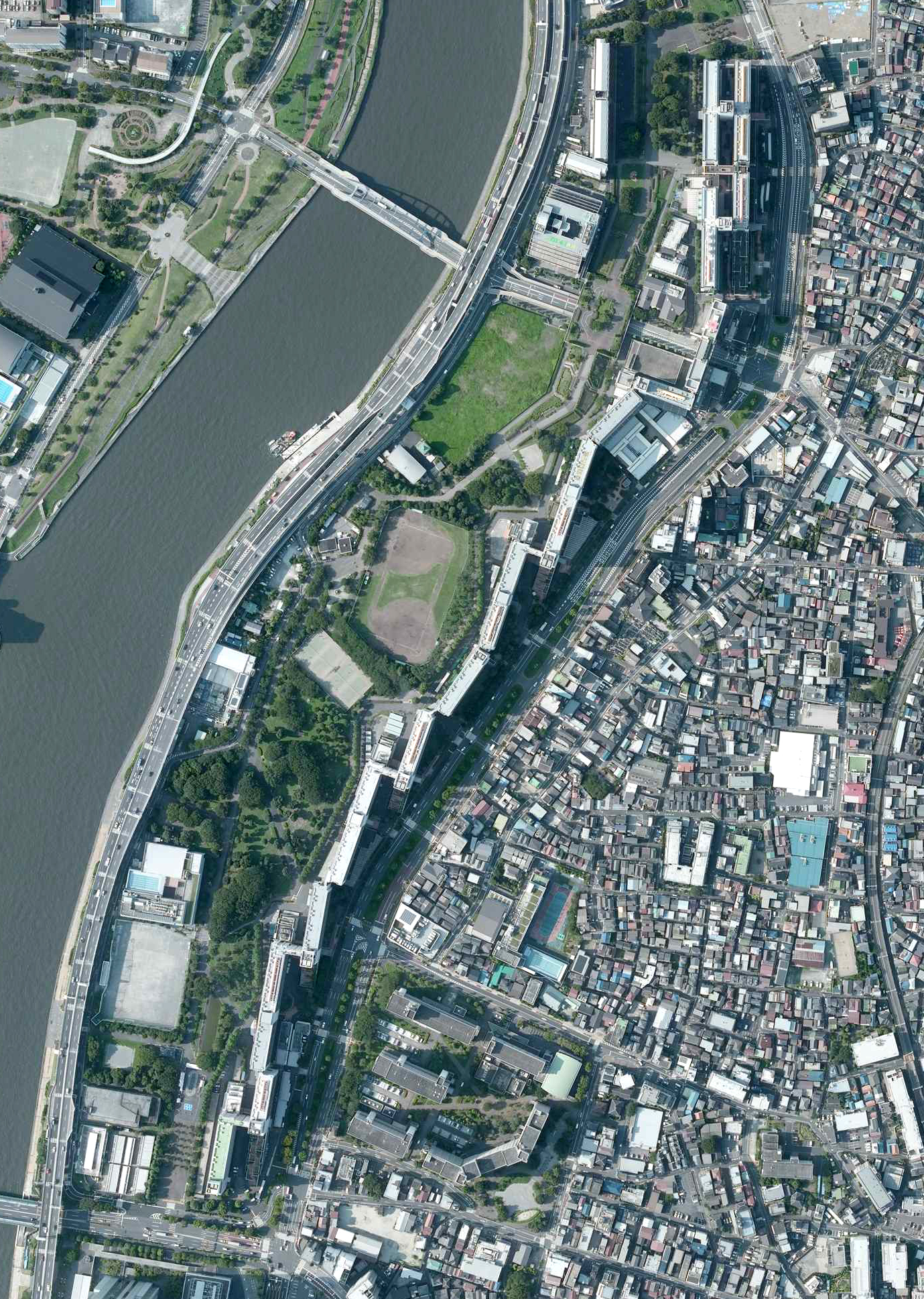
    From above, the apartments form a continuous barrier protecting the park beside the river. Image made from National Land Image Information, Ministry of Land, Infrastructure, Transport and Tourism of Japan
    From above, the apartments form a continuous barrier protecting the park beside the river. Image made from National Land Image Information, Ministry of Land, Infrastructure, Transport and Tourism of Japan.

    How to turn homes into a fortress

    The buildings are separate structures so that each can move during an earthquake. Expansion joints connect them.

    That flexibility creates gaps—and fire loves gaps.

    So the designers installed large steel doors and shutters at the connections. In an emergency, the openings can close, transforming the row of buildings into a more continuous barrier.

    On the street-facing side, balconies have fire shutters intended to protect apartment openings. Deep concrete overhangs help block heat. Rotating water cannons were positioned near evacuation gates, while drenchers could spray water over parts of the structure.

    Some of these older systems have changed or been placed out of operation over the decades, but much of the defensive architecture remains visible from public paths.

    Do not enter private corridors looking for equipment. The complex is not an abandoned attraction or open-air museum. People live here.

    The strangest features are underground

    The visible wall is only part of the system.

    The ground below the complex contains water-storage spaces, emergency power equipment, stockpiles and passages used for disaster operations. JKK Tokyo has described underground routes and monitoring facilities that are normally closed to the public.

    The foundations were designed to reach stronger geological layers below the soft ground. Large basement water tanks also help the structures resist overturning.

    The original plan was for the approximately nine-hectare refuge area to accommodate around 80,000 people and support them with water, food and medical supplies for roughly one week.

    Imagine the logistics: a temporary city larger than many Japanese towns, protected behind the walls of another city where thousands of residents already live.

    The red floor is not decoration

    At one point the apartment wall steps downward like a giant staircase. This is sometimes called the disaster-prevention terrace.

    It creates an escape route from around the fifth-floor level toward the ground. Parts of the evacuation route were colored red so they could be recognized quickly.

    Elsewhere, broad gates pass through the residential wall. In daily life they connect the neighborhood to the park. During a fire, shutters can close behind evacuees.

    Once you understand the design, ordinary details begin looking suspicious. A bridge is also a shutter housing. A balcony is also a firebreak. A park bench may become a cooking stove. A manhole may conceal an emergency toilet.

    The entire landscape has a second job.

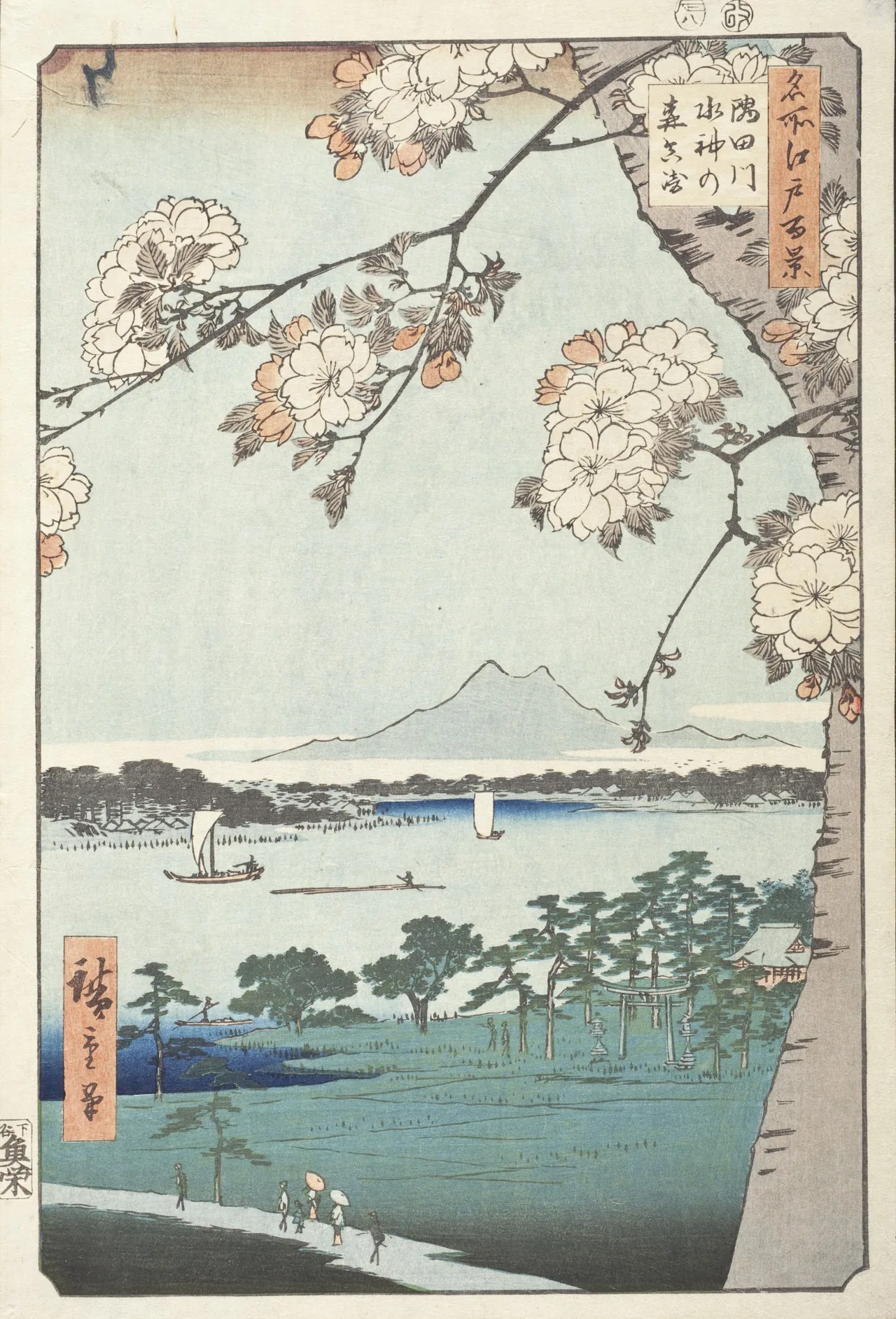
    Hiroshige woodblock print of the Sumida River landscape near present-day Tsutsumidori
    Hiroshige depicted the Sumida River landscape around present-day Tsutsumidori in the 1850s, long before the defensive apartments. LACMA / Wikimedia Commons, public domain.

    This is not a ruin

    That distinction matters.

    Shirahige-Higashi is fascinating because its unusual architecture is part of normal life, not because it has been abandoned.

    Laundry hangs behind structures intended to resist an urban fire. Delivery scooters pass beneath emergency shutters. The great concrete defense line contains homes, community organizations and decades of memories.

    Visitors should remain on public streets and park paths, avoid photographing residents at close range and never try to enter controlled areas. You do not need access to the basement or monitoring tower to understand the scale.

    Walk the length of the park. The repetition does the work.

    Does the system still work?

    The honest answer is more complicated than yes or no.

    The complex is more than forty years old. Some original equipment has aged, building standards have changed and residents have questioned how tens of thousands of outside evacuees would be supported by the community during a real catastrophe.

    But disaster preparedness is not frozen in 1982. Local associations continue drills, agencies renew facilities, and the park still contains modern emergency functions.

    The most important legacy may be the idea itself: housing, landscape and civil defense do not have to be separate projects.

    Shirahige-Higashi made an entire residential district perform as infrastructure.

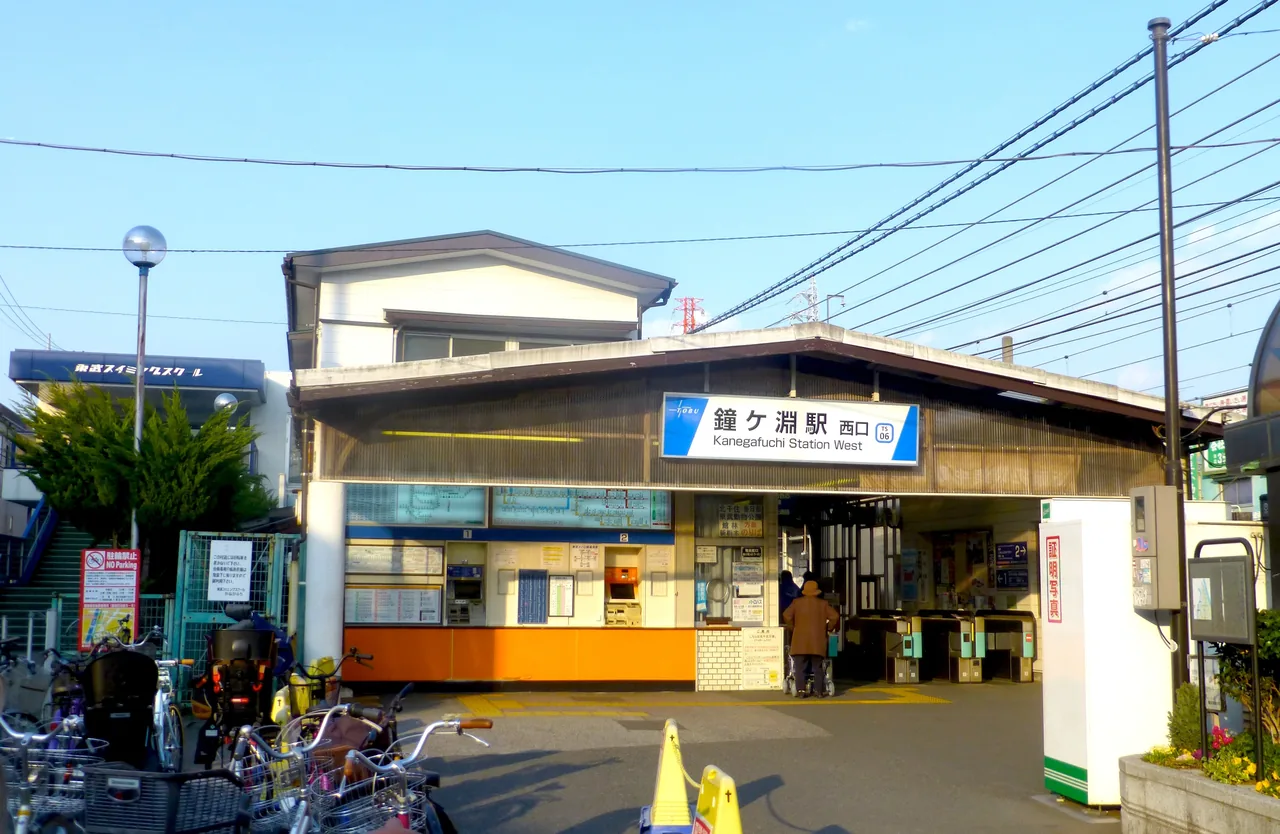
    The small west entrance of Kanegafuchi Station in Sumida Tokyo
    Kanegafuchi is a small local station, far from the atmosphere of central Tokyo. Photo: Nesnad / Wikimedia Commons, CC BY-SA 3.0.

    A deeper Sumida walking route

    1. Kanegafuchi Station — leave the Tobu Skytree Line at a station most overseas visitors pass without noticing.
    2. Street-facing apartment wall — walk south along the eastern side and look for water cannons, shutter housings and connected blocks.
    3. Emergency gates — pass through only where normal public access is clearly allowed.
    4. Higashi-Shirahige Park — turn around and view the long residential barrier from the space it was built to defend.
    5. Sumida River — walk along the river side for the contrast between open water, trees and defensive concrete.
    6. Kyojima — continue by train or on foot toward one of eastern Tokyo’s surviving wooden neighborhoods.

    For the local streets that explain why fire prevention mattered so much here, read our guide to Kyojima and Kirakira Tachibana Shopping Street.

    For another piece of infrastructure buried inside a disaster-prevention park, see the Old Komatsugawa Lock.

    Before you go

    • Name: Shirahige-Higashi Apartments / 都営白鬚東アパート.
    • Area: Tsutsumidori 2-chome, Sumida City, Tokyo.
    • Park: Higashi-Shirahige Park, 2-2-1 Tsutsumidori.
    • Nearest station: Kanegafuchi Station on the Tobu Skytree Line.
    • Walking time: Around ten minutes from the station to the park.
    • Admission: Free.
    • Hours: The metropolitan park is always open, although individual facilities have separate hours.
    • Time needed: Allow 60–90 minutes to walk the complex and park without rushing.
    • Photography: Photograph architecture from public areas. Avoid identifiable residents, homes and private corridors.
    • Important: This is an occupied residential complex, not a tourism facility. Do not test, touch or obstruct emergency equipment.

    Tokyo’s strangest architecture often hides behind ordinary routines.

    At Shirahige-Higashi, people cook dinner inside a firewall. Children cross an evacuation zone to reach the playground. A kilometer of concrete waits quietly for a disaster everyone hopes will never arrive.

    It is not beautiful in the usual Tokyo-guide sense.

    It is something rarer: an entire neighborhood designed to become a machine at the exact moment the city begins to fail.

    Related: Tattoo-friendly sento on the east side: Koganeyu and Daikokuyu are a short walk from here.


    Researched using current information from JKK Tokyo, the Cabinet Office disaster-prevention archive, the original project designers’ Shirahige-Higashi report and the official park guide, checked September 12, 2026. This is a researched cultural guide, not a firsthand visit report. Equipment status and access conditions may change.

    Where this joins the rest of the east side

    Shirahige-Higashi is the northern end of the Sumida River walk, an hour on foot from the Skytree. The same fear of fire shaped the whole delta: the buried lock at Komatsugawa sits inside another disaster-prevention park. Afterwards, the tattoo-friendly Daikokuyu and Koganeyu baths are a short bus ride south. All of it is in the same ward: things to do in Sumida City, in the order we would do them.

    Quick answers

    What is the Shirahige-Higashi apartment complex?

    A 1.2-kilometer row of 18 connected public-housing blocks, about 40 meters high, along the Sumida River in northern Sumida City. Completed in 1982, it was designed to become a firewall protecting Higashi-Shirahige Park, where up to 80,000 people could shelter after an earthquake.

    Can you visit the Shirahige-Higashi firewall?

    Yes, from public paths and the park. The steel shutters, deep balconies and water cannons are visible from outside. People live there, so do not enter corridors or private areas. Nearest stations: Kanegafuchi (Tobu Skytree line) or Higashi-Mukojima.

    Why did Tokyo build an apartment firewall?

    Because of the 1923 Great Kanto Earthquake, when a fire whirl killed tens of thousands sheltering on open ground in what is now Sumida, and the 1945 firebombing. The 1969 plan created six disaster-prevention bases in the Koto delta; Shirahige-Higashi was the model project.

    Do the fire defenses still work?

    Much of the defensive architecture remains, including the shutters and gates. Some of the older water systems have been changed or taken out of operation over the decades; underground water storage, power and stockpiles are maintained but closed to the public.

    Written by Kizuku. I run the Sunamachi Ginza Sumo Stable, a sumo experience in Koto City, and I write about the east side of Tokyo I live and work in. More about this site →

  • Tokyo Buried This Giant River Gate Inside a Park.

    Tokyo Buried This Giant River Gate Inside a Park.

    This article may contain affiliate links to booking sites. If you book through them, LOCAL SIDE JAPAN earns a small commission at no extra cost to you. How this site is made →

    TOKYO / EDOGAWA / BURIED INFRASTRUCTURE

    There is a giant concrete gate buried inside an ordinary Tokyo park.

    It does not open. It does not lead anywhere. There is no canal in front of it and no boat can pass through it.

    Only its upper section rises above the grass, like the entrance to a building that Tokyo forgot to finish digging out.

    This is the Old Komatsugawa Lock. It once lifted and lowered working boats between waterways with different water levels. After it closed, redevelopment raised the surrounding ground and swallowed most of the structure.

    Tokyo did not demolish the lock. It buried it standing up.

    Only the upper section remains visible above today’s park
    Only the upper section remains visible above today’s park. Photo: Hanakurorin / Wikimedia Commons, CC0.

    A ruin without the usual signs of a ruin

    You find it in the Wind Plaza of Ojima-Komatsugawa Park, a few minutes from Higashi-ojima Station.

    The surroundings are aggressively normal. Joggers pass. Children play nearby. Apartment towers rise beyond the trees. Then a heavy concrete arch appears from the lawn.

    Its metal mechanisms are still attached. The curved top resembles part of an industrial fortress, but the base disappears directly into the earth.

    There is no dramatic entrance fee, abandoned tunnel or guided tour. The strange thing is simply standing there, exposed and unexplained unless you stop to read.

    Most visitors to the park are not visiting it at all.

    What exactly is a lock?

    A lock is a water elevator for boats.

    When two rivers or canals have different surface levels, a boat enters a chamber between two gates. One gate closes. Water is added or released until the chamber matches the level on the other side. The second gate then opens and the boat continues.

    The principle is the same one used at the Panama Canal, reduced here to the scale of Tokyo’s working waterways.

    Before trucks and expressways took over, boats moved rice, salt, soy sauce, timber, fuel and other heavy goods through eastern Tokyo. The canals were not decoration. They were roads made of water.

    Tokyo created a flood-control problem—and engineered around it

    Eastern Tokyo has always lived with water. Rivers brought trade, but they also brought devastating floods.

    In the early twentieth century, engineers cut the Arakawa Floodway to carry floodwater safely toward Tokyo Bay. The river now commonly called the Arakawa is largely the result of that enormous project.

    The new channel protected the city, but it created a practical problem. The Arakawa and the connected Old Nakagawa and Onagi River did not share the same water level. Boats could no longer move easily between them.

    The Komatsugawa Lock was completed in 1930 to solve that problem. Its chamber had gates at both ends, controlling water so vessels could cross between the great floodway and Tokyo’s inner canal network.

    It was infrastructure built to repair the side effect of other infrastructure.

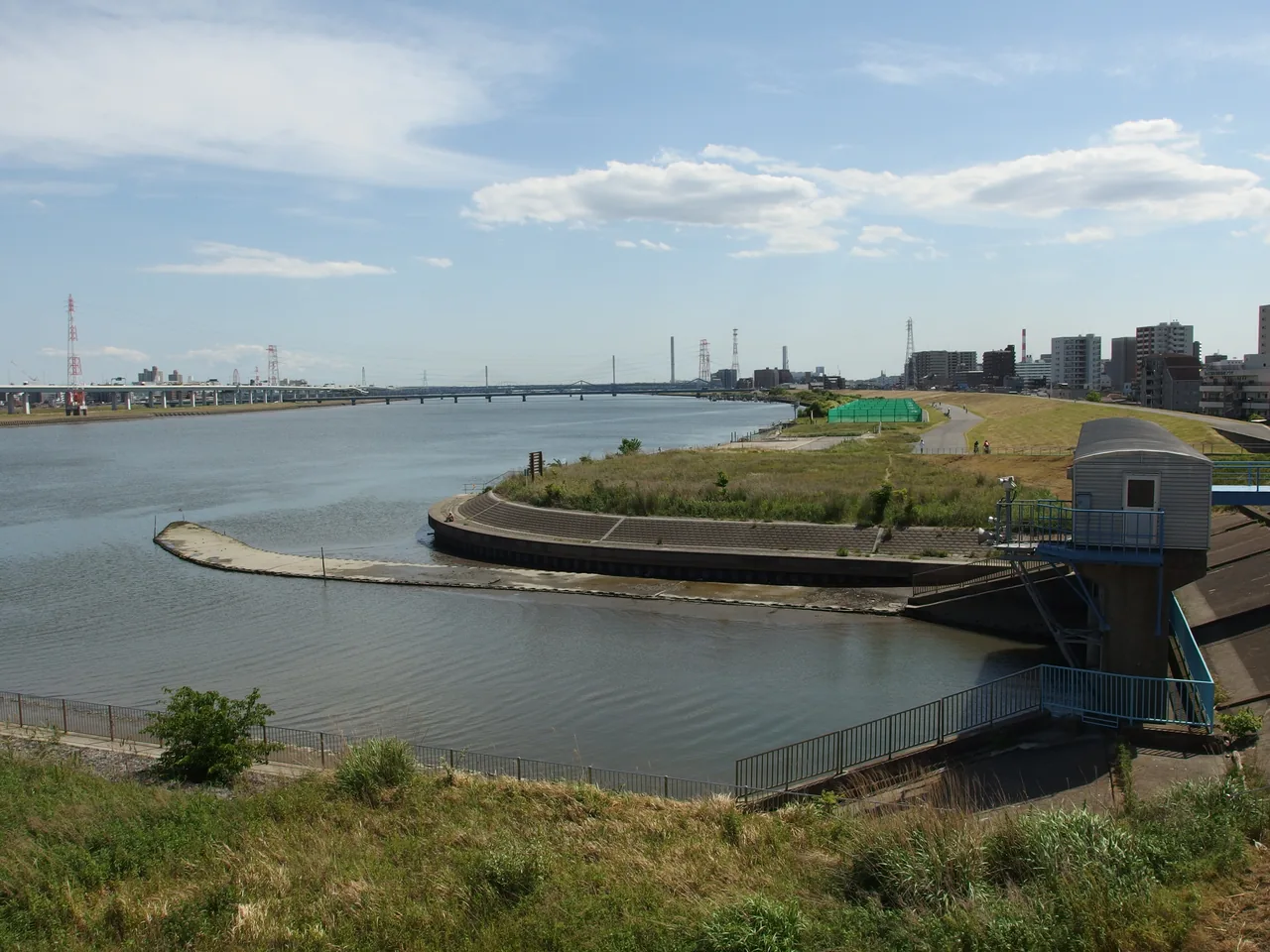
    The wide Arakawa River and flood-control landscape in eastern Tokyo
    The broad Arakawa floodway reshaped transport and flood control across eastern Tokyo. Photo: Guilhem Vellut / Wikimedia Commons, CC BY 2.0.

    Then Tokyo stopped needing the gate

    The lock belonged to a city where freight moved by boat.

    Postwar Tokyo chose roads. Trucks became faster and more flexible, canal traffic declined and the old lock lost its purpose. It was closed in the late 1970s.

    Normally, obsolete infrastructure disappears. Tokyo tears it down, builds over it and gives the new development a polished name.

    Komatsugawa received a stranger ending.

    Large-scale redevelopment transformed this low-lying district into a disaster-prevention park and raised the ground level. Of the lock’s two gates, only the rear gate on the Old Nakagawa side was preserved. The new earth covered much of it.

    The visible arch is therefore not a small monument shaped like the old structure. It is the real structure, continuing below your feet.

    The park itself is emergency infrastructure

    Ojima-Komatsugawa Park looks like open recreational space, but its emptiness has a job.

    The park spans parts of Edogawa and Koto wards and was developed as a large disaster-prevention site. In a major earthquake or urban fire, its broad lawns provide evacuation space away from dense streets and buildings.

    This creates a remarkable stack of Tokyo history.

    At the bottom is an old industrial waterway. Above it stands a 1930 lock built for cargo boats. Around the buried lock is a modern park designed to protect residents from a different kind of disaster. Beyond that are high-rise housing blocks created through redevelopment.

    One piece of land is doing several generations of urban work at once.

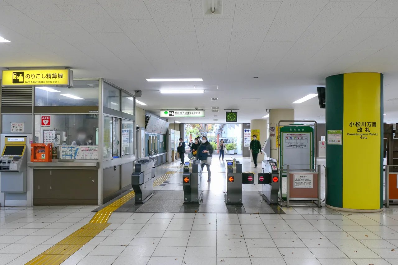
    Komatsugawa exit ticket gates at Higashi-ojima Station in eastern Tokyo
    Leave Higashi-ojima Station through the Komatsugawa exit for the shortest approach. Photo: MaedaAkihiko / Wikimedia Commons, CC BY-SA 4.0.

    The emperor came to look at it

    Here is an odd measure of how hidden this place is.

    In May 2023, Emperor Naruhito inspected the Old Komatsugawa Lock, the modern Arakawa Lock Gate and the Nakagawa Funabansho Museum as part of a visit focused on the history of water transport and flood control.

    The official park page mentions the imperial visit. Yet many Tokyo residents have never heard of the structure, and most overseas travel guides ignore it completely.

    It is simultaneously important enough for an emperor and obscure enough to have no queue.

    Walk from the dead lock to its living replacement

    Do not travel across Tokyo only to photograph the old gate for five minutes. The better experience is to follow the water system.

    From the buried lock, walk south beside the Old Nakagawa toward the modern Arakawa Lock Gate, completed in 2005.

    The modern structure performs essentially the same trick. It adjusts a water-level difference of up to about 3.1 meters between the Arakawa and Old Nakagawa, allowing boats to pass. The trip through the chamber takes roughly twenty minutes.

    Its purpose is not only transport. If roads and railways fail after a major earthquake, the connected waterways can carry relief supplies, equipment and evacuees into eastern Tokyo.

    The old lock moved the commercial life of the city. The new one waits for the day it may have to help save it.

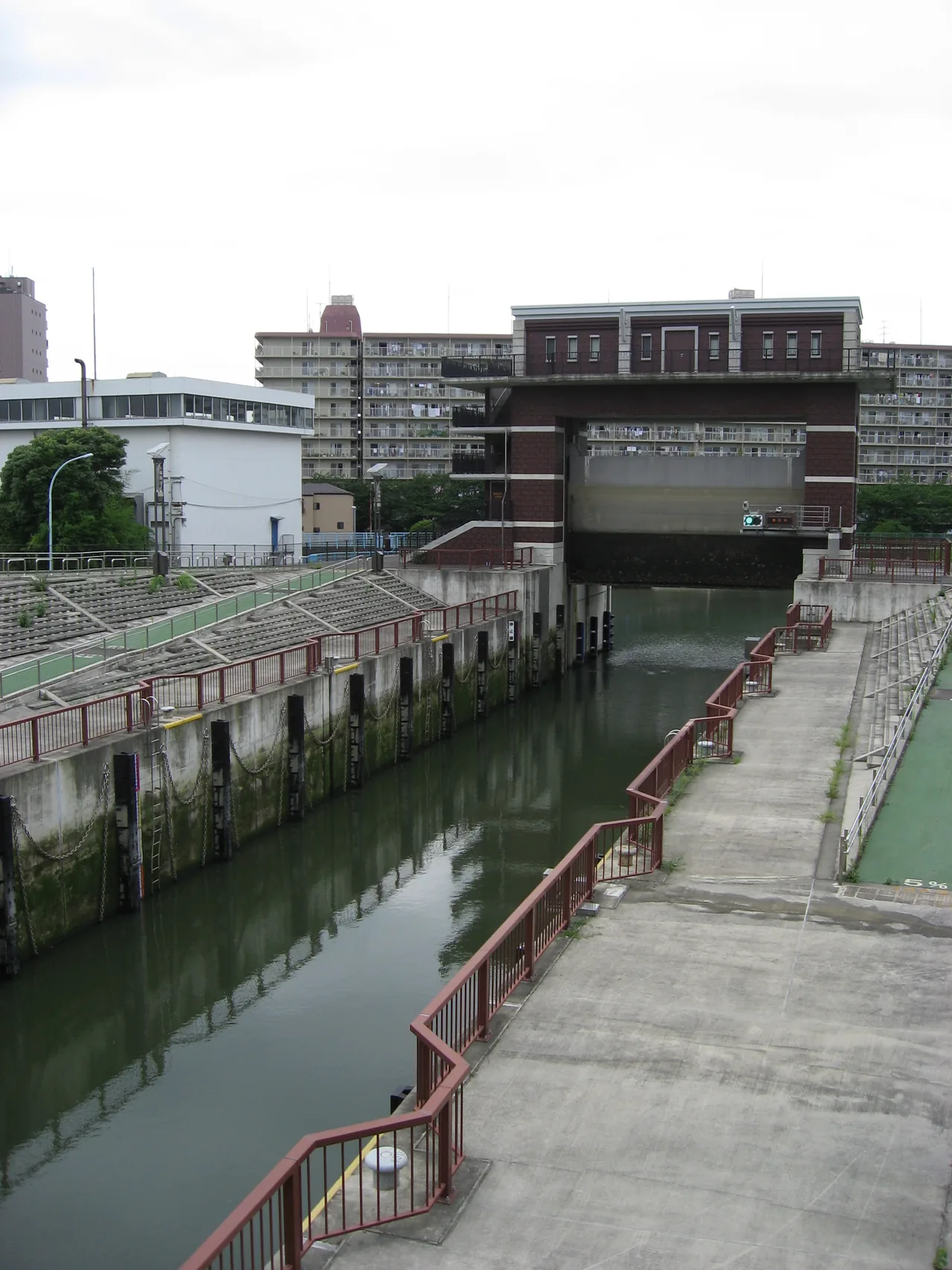
    The tall concrete towers and water chamber of the modern Arakawa Lock Gate
    The modern Arakawa Lock Gate continues the old lock’s work downstream. Photo: ZCU / Wikimedia Commons, CC BY-SA 3.0.

    A deep-east Tokyo walking route

    1. Higashi-ojima Station, Komatsugawa Exit — the station itself crosses the Old Nakagawa and sits on the border between two wards.
    2. Old Komatsugawa Lock — inspect the machinery and imagine the missing chamber beneath the park.
    3. Old Nakagawa riverside — follow the quiet water south rather than returning to the station.
    4. Arakawa Lock Gate — compare the buried ruin with its functioning modern successor.
    5. Nakagawa Funabansho Museum — learn how officials inspected boats and cargo entering Edo through the Onagi River.

    For the wider story of this water network, read our guide to the lost boat checkpoint that controlled cargo entering Edo.

    You can also continue west through Koto City toward the river park where local residents still travel by hand-pulled boat.

    Before you go

    • Name: Old Komatsugawa Lock / 旧小松川閘門.
    • Location: Wind Plaza, Ojima-Komatsugawa Park, 1-1 Komatsugawa, Edogawa City, Tokyo.
    • Nearest station: Higashi-ojima Station on the Toei Shinjuku Line.
    • Exit: Use the Komatsugawa Exit, then cross the park toward Wind Plaza.
    • Admission: Free.
    • Opening hours: The outdoor monument is in a public park and can be viewed without museum admission.
    • Time needed: Ten minutes for the structure; two to three hours for the full riverside route.
    • Best light: Late afternoon makes the concrete texture and buried shape more visible.
    • Accessibility: Park paths are generally broad, but routes and gradients vary around the raised areas.
    • Respect the site: Do not climb on the gate or enter planted and restricted sections.

    Tokyo usually displays history behind glass.

    Here, history is under the lawn.

    The gate survived because the city built a new city around it—higher ground, new apartments, a disaster park and a different transport system.

    Stand beside it and remember that the strange concrete crown is only the visible fraction.

    The rest of old Tokyo is still down there.


    Researched using current information from the Tokyo Historic Architecture Project, Edogawa City and the official Ojima-Komatsugawa Park guide, checked September 12, 2026. This is a researched cultural guide, not a firsthand visit report. Access conditions may change.

    Where this joins the rest of the east side

    The lock is one end of a waterway day: the Onagi River and the Nakagawa boat checkpoint are next door, the ¥100 boats on the Yokojukken are twenty minutes south, and Kiyosumi-Shirakawa is where the canals reach the old city.

    Quick answers

    Where is the Old Komatsugawa Lock?

    In the Wind Plaza of Ojima-Komatsugawa Park, a few minutes from Higashi-Ojima Station (Toei Shinjuku line), on the border of Edogawa and Koto cities. Use the Komatsugawa exit. The park is free and always open.

    Why is the Komatsugawa Lock buried?

    It closed in the late 1970s when freight moved from canals to trucks. Redevelopment then raised the ground level of the low-lying district to create a disaster-prevention park, covering most of the structure. Only the upper part of the rear gate on the Old Nakagawa side is visible.

    What did the Komatsugawa Lock do?

    Completed in 1930, it lifted and lowered boats between the new Arakawa floodway and the Old Nakagawa and Onagi rivers, which had different water levels. It was infrastructure built to fix a side effect of Tokyo’s flood-control works.

    Is there anything else to see nearby?

    The modern Arakawa Lock Gate and the Nakagawa Funabansho Museum, both inspected by Emperor Naruhito in 2023, are a short walk along the river. The park itself is an evacuation site with wide lawns.

    Written by Kizuku. I run the Sunamachi Ginza Sumo Stable, a sumo experience in Koto City, and I write about the east side of Tokyo I live and work in. More about this site →

  • Tokyo Has a Museum Built Around One Fishing Boat.

    Tokyo Has a Museum Built Around One Fishing Boat.

    This article contains affiliate links to booking sites. If you book through them, LOCAL SIDE JAPAN earns a small commission at no extra cost to you. The place itself is free and is described first. How this site is made →

    TOKYO / KOTO CITY / HIDDEN HISTORY

    Tokyo has a museum built around one fishing boat.

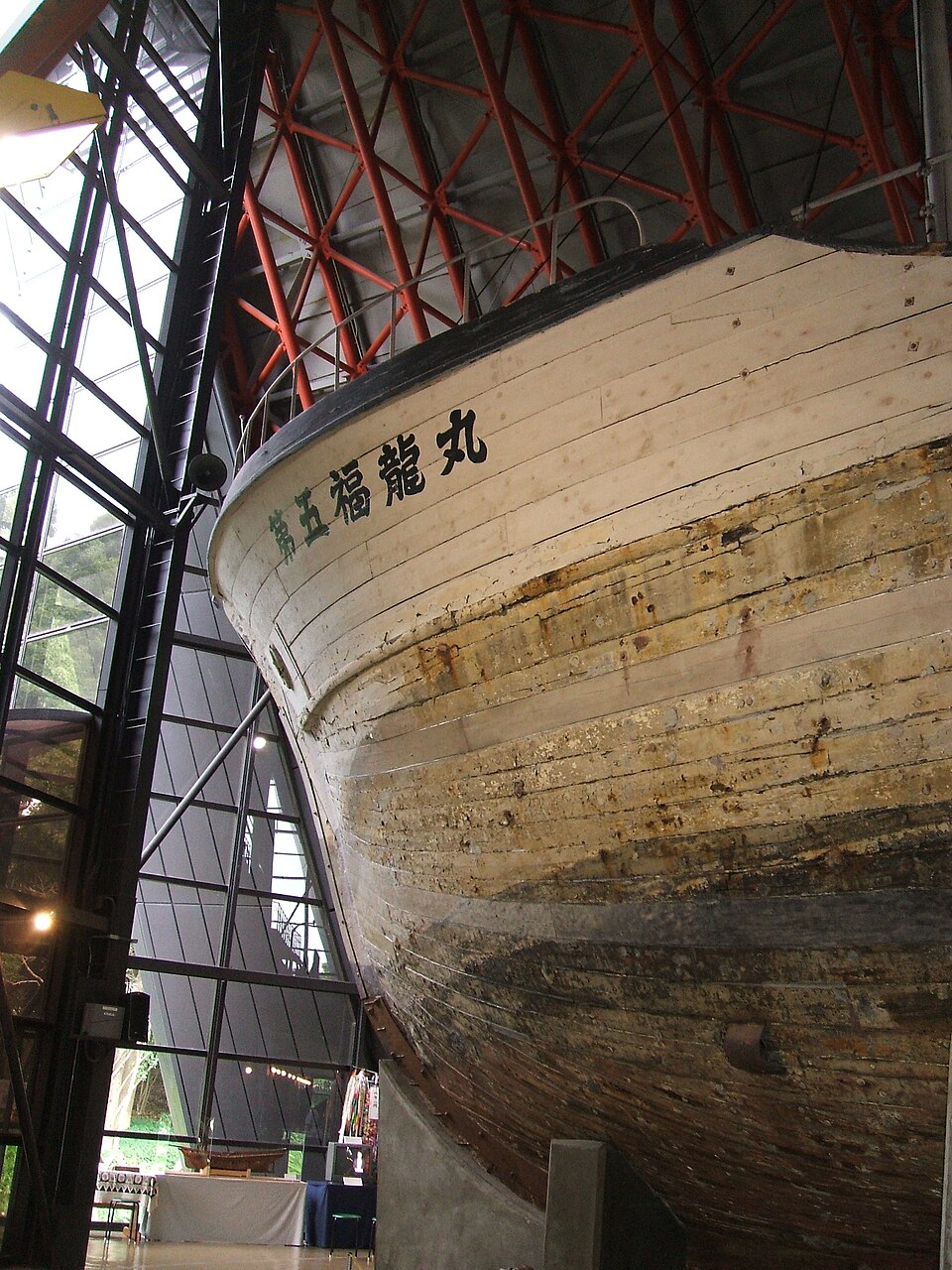
    Not a replica. Not a digital projection. The actual wooden vessel fills the building from bow to stern.

    Its name is Daigo Fukuryu Maru—Lucky Dragon No. 5.

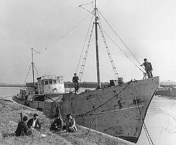
    In 1954, its 23 crew members were caught in radioactive fallout from a United States hydrogen-bomb test at Bikini Atoll. Years later, the abandoned boat was found on Tokyo’s former garbage island and saved by citizens.

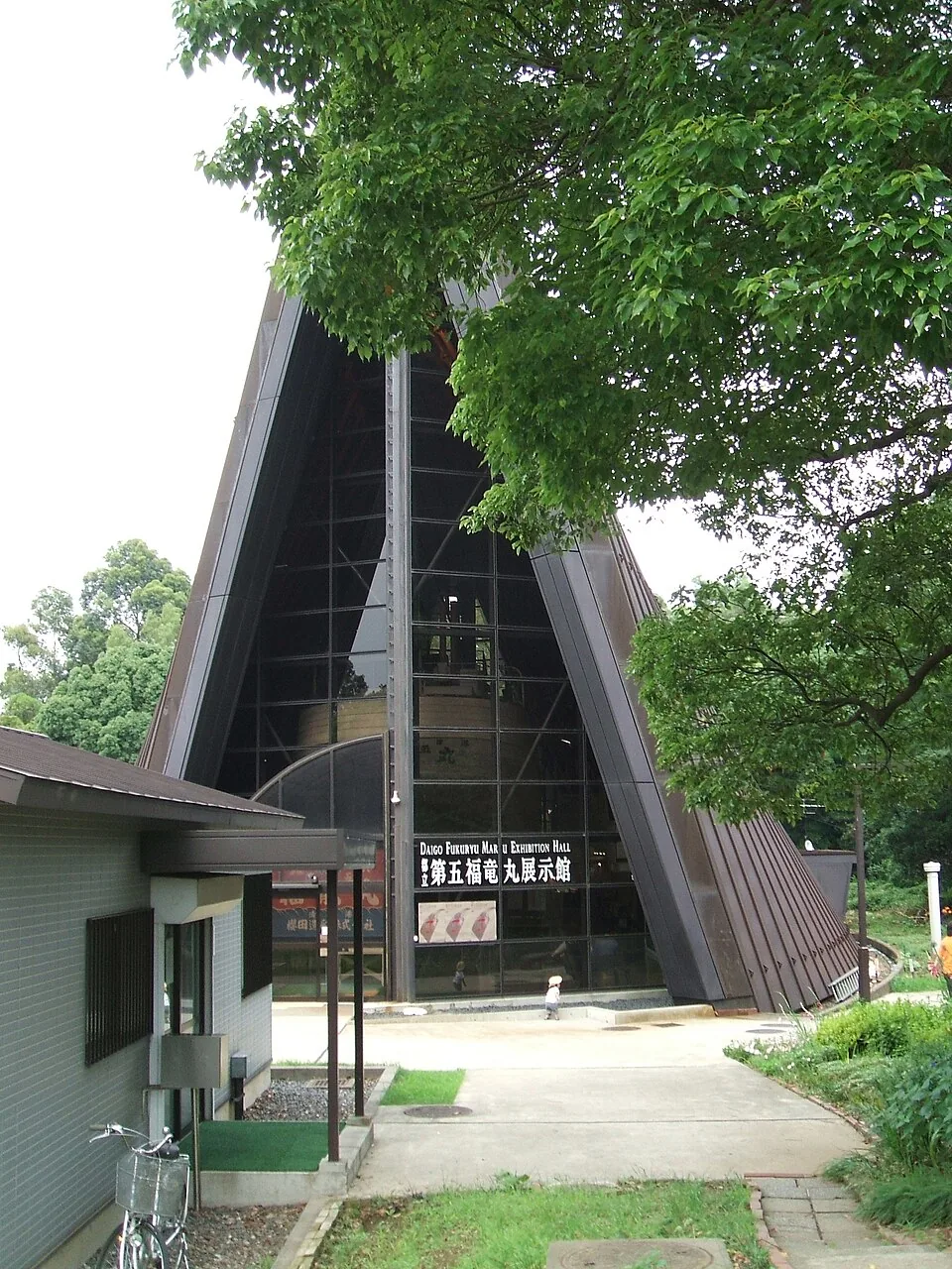
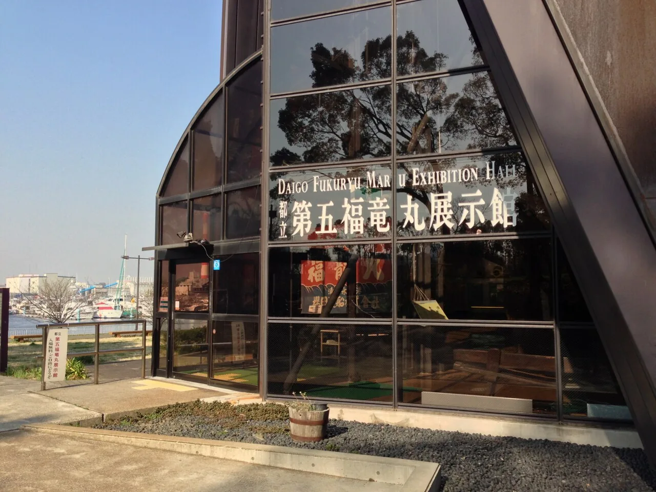
    Today it stands inside a quiet, free museum in Yumenoshima Park, less than 15 minutes by train from Tokyo Station and almost entirely absent from most Tokyo itineraries.

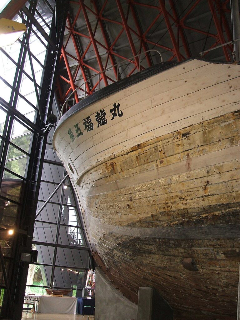
    The preserved wooden fishing boat Daigo Fukuryu Maru inside its Tokyo exhibition hall
    The preserved Daigo Fukuryu Maru inside the exhibition hall. Photo: carpkazu / Wikimedia Commons, CC BY-SA 3.0.

    Fast facts

    • Admission: Free
    • Hours: 9:30–16:00
    • Closed: Mondays, or the next weekday when Monday is a public holiday
    • Address: Inside Yumenoshima Park, 2-1-1 Yumenoshima, Koto City, Tokyo
    • Nearest: Shinkiba Station, about 10 minutes on foot

    A normal fishing trip entered the nuclear age

    Daigo Fukuryu Maru was built in Wakayama Prefecture in 1947, first as a bonito boat and later converted for deep-sea tuna fishing from Yaizu Port in Shizuoka.

    On March 1, 1954, the crew was fishing about 160 kilometers east of the test site at Bikini Atoll in the Marshall Islands.

    They saw a sudden flash in the west. Minutes later came a sound like an earthquake. Then white material began falling onto the deck.

    The fishermen called it shi no hai—“ashes of death.” It was pulverized coral made radioactive by the explosion.

    The 23 men worked to return to Japan while the fallout remained on their boat, clothes, skin and catch. By the time they reached Yaizu, all were suffering symptoms of radiation exposure.

    The bomb was far larger than expected

    The test was called Castle Bravo. The bomb produced a yield of 15 megatons—about 1,000 times the explosive power of the atomic bomb dropped on Hiroshima, according to the exhibition hall.

    Its radioactive contamination spread beyond the test area. Daigo Fukuryu Maru became the best-known Japanese vessel involved, but it was not the only one. The museum’s research states that hundreds of Japanese fishing vessels landed contaminated tuna during 1954.

    The Marshall Islands suffered the direct and continuing consequences of 67 American nuclear tests conducted between 1946 and 1958. Several communities remain displaced from their home islands.

    This is why the exhibition hall prefers the broader term “Bikini Incident”. A story centered only on one Japanese boat can make the affected Marshallese communities—and the wider Pacific contamination—disappear from view.

    Historic black and white photograph of Daigo Fukuryu Maru before the 1954 Bikini incident
    Daigo Fukuryu Maru in the early 1950s, before the incident. Unknown photographer, via Wikimedia Commons, public domain.

    The tuna became national news

    The contaminated catch was called “atomic tuna.” Fish markets searched for affected shipments, tuna was buried or destroyed, and public fear spread far beyond one crew.

    The boat’s chief radio operator, Aikichi Kuboyama, died in September 1954 after months of treatment. His death became a powerful symbol in Japan’s growing movement against atomic and hydrogen bombs.

    The incident also changed Japanese popular culture. The original Godzilla appeared in cinemas later that year, opening with a fishing boat destroyed by a mysterious flash at sea. The connection is not subtle. Japan’s giant radioactive monster arrived in the same national atmosphere of shock and fear.

    That does not make this a Godzilla attraction. It makes the museum one of the real places that helps explain why the film meant more than a man in a monster suit stepping on buildings.

    How did the boat end up in a Tokyo park?

    After radiation levels fell and safety was confirmed, the vessel was rebuilt as a training ship named Hayabusa Maru for the Tokyo University of Fisheries.

    It was retired in 1967, sold for dismantling and eventually abandoned on reclaimed land at Yumenoshima.

    At that time, Yumenoshima was known as a huge garbage-disposal site. The name means “Dream Island,” which is either optimistic urban planning or extremely aggressive rebranding.

    Citizens learned that the vessel was lying there and organized a movement to preserve it. The Tokyo Metropolitan Government opened the exhibition hall in 1976.

    The boat survived because ordinary people decided that throwing it away would also throw away the memory attached to it.

    The vessel’s bow and name
    The vessel’s bow and name. Photo: carpkazu / Wikimedia Commons, public domain.

    What it feels like inside

    The building is shaped around the ship. Walk in and the scale becomes immediate: roughly 30 meters long, six meters wide, 15 meters high and 140 tons.

    Wooden deep-sea fishing boats like this were once part of Japan’s postwar struggle to secure food. The hull is therefore two kinds of evidence at once—evidence of ordinary working life and evidence of nuclear damage.

    Exhibits cover the crew, contaminated tuna, radioactive rain, nuclear testing across the Pacific, settlements between Japan and the United States, the Marshall Islands and the international anti-nuclear movement.

    Outside are the vessel’s engine, a tuna memorial and a memorial to Aikichi Kuboyama.

    English information is available on the museum’s website, but the official site states that no English guide is provided for group tours. Use your phone’s translation camera for Japanese panels and allow enough time to read slowly.

    A museum that asks more than “what happened?”

    The obvious question is what happened to the fishermen.

    The more difficult questions come later. Who was warned? Whose suffering became visible? Whose remained distant? What does a country save, and what does it allow to disappear?

    This small Tokyo museum does not provide a comfortable sightseeing break. It provides something more valuable: a physical object that makes an enormous historical event human-sized.

    Twenty-three men went to catch tuna. One wooden boat returned carrying evidence of a nuclear test occurring far beyond Japan.

    Entrance of the Daigo Fukuryu Maru Exhibition Hall in Yumenoshima Park, Tokyo
    The exhibition hall entrance in Yumenoshima Park. Photo: Tokyo-Walk / Wikimedia Commons, CC BY-SA 3.0.

    Make it a Yumenoshima half-day

    1. Shinkiba Station — arrive by the JR Keiyo Line, Tokyo Metro Yurakucho Line or Rinkai Line.
    2. Daigo Fukuryu Maru Exhibition Hall — allow 60–90 minutes if you want to read rather than simply photograph the ship.
    3. Yumenoshima Park — walk through the eucalyptus trees and open lawns.
    4. Yumenoshima Tropical Greenhouse Dome — add the greenhouse if it is open and you want a complete change of atmosphere.
    5. Tokyo Yumenoshima Marina — finish beside the modern boats, a strange visual contrast with the wooden vessel inside the museum.

    From Sunamachi Ginza, use a local bus or connect through Toyocho and Shinkiba depending on your starting point. Check a live route planner on the day because the best connection changes by time.

    Before you go

    • Official name: Daigo Fukuryu-Maru Exhibition Hall / 東京都立第五福竜丸展示館.
    • Address: Inside Yumenoshima Park, 2-1-1 Yumenoshima, Koto City, Tokyo.
    • Current hours: 9:30–16:00.
    • Admission: Free.
    • Regular closure: Mondays, or the following weekday when Monday is a public holiday.
    • Access: About ten minutes on foot from Shinkiba Station.
    • Language: The official website has English information; bring camera translation for detailed Japanese panels.
    • Photography: Follow the signs and staff instructions inside the exhibition hall.
    • Latest information: Check the museum’s news page before traveling because temporary closures and events may affect access.

    Tokyo is good at replacing what no longer seems useful.

    This boat escaped that fate.

    It was built to catch fish, exposed by a bomb, renamed, retired, abandoned and finally saved—not because it was beautiful, but because forgetting it would have been easier.

    Some places are worth visiting because they are fun.

    This one is worth visiting because it refuses to let history become abstract.


    Researched using current information from the Daigo Fukuryu-Maru Exhibition Hall, its official history and official access guide, checked September 12, 2026. This is a researched cultural guide, not a firsthand visit report. Hours and exhibition conditions may change.

    Making a day of it: Yumenoshima is two stops from Toyosu on the Yurakucho line, and most people combine this free museum with teamLab Planets (date-priced from about ¥3,800; Klook sells the official ticket at face value) or the fish market. Do the boat first, in the morning, when the hall is empty; the contrast with the art museum afterwards is the point.

    Where this joins the rest of the east side

    Yumenoshima is the seaward end of Koto City. The Onagi River checkpoint and the Yokojukken boat park are the same ward’s inland water story; Kiyosumi-Shirakawa, with the Fukagawa Edo Museum, is two stops from Tokyo Station on the way back. All the ward’s stories are on the Koto City page.

    Quick answers

    Where is the Daigo Fukuryu Maru museum and how much is it?

    In Yumenoshima Park, Koto City, about five minutes from Shin-Kiba Station (JR Keiyo, Yurakucho and Rinkai lines), 15 minutes by train from Tokyo Station. Admission is free. Closed Mondays.

    What happened to the Daigo Fukuryu Maru?

    On March 1, 1954 the tuna boat was fishing 160 km from Bikini Atoll when the US Castle Bravo H-bomb test (15 megatons) showered it with radioactive coral ash. All 23 crew suffered radiation sickness; radio operator Aikichi Kuboyama died in September 1954.

    Is the boat in the museum the real one?

    Yes. After decontamination it served as a training ship, was abandoned on the Yumenoshima landfill in 1967, and was saved by a citizens’ campaign. The 30-meter wooden vessel has filled the purpose-built hall since 1976.

    Is the Daigo Fukuryu Maru connected to Godzilla?

    Yes. The original Godzilla film opened later in 1954 with a fishing boat destroyed by a flash at sea, a direct reference to the incident and the national fear of ‘atomic tuna’ it caused.

    Written by Kizuku. I run the Sunamachi Ginza Sumo Stable, a sumo experience in Koto City, and I write about the east side of Tokyo I live and work in. More about this site →

  • Tokyo Has a ¥100 Boat Park. Almost Nobody Knows It.

    Tokyo Has a ¥100 Boat Park. Almost Nobody Knows It.

    This article contains affiliate links to booking sites. If you book through them, LOCAL SIDE JAPAN earns a small commission at no extra cost to you. The place itself is free and is described first. How this site is made →

    TOKYO / KOTO CITY / LOCAL WATERWAYS

    Tokyo has a park where you can row a wooden boat, pass a tiny rice field and pay just ¥100 for half an hour on the water.

    It is not beside Mount Fuji. It is not in a preserved village. It is wedged between apartment blocks, local roads and the everyday neighborhoods of Koto City.

    This is Yokojukken-gawa Shinsui Park—a 1.9-kilometer waterside park close to Sunamachi Ginza, built from part of an old canal.

    Come here after eating your way through the shopping street. Tokyo will suddenly become slower, greener and slightly harder to explain.

    A quiet canal and trees inside Yokojukken-gawa Shinsui Park in Tokyo
    A quiet stretch of the park’s canal. Photo: Guilhem Vellut / Wikimedia Commons, CC BY 2.0.

    Fast facts

    • Admission: The park is free
    • Rowing and pedal boats: ¥100 per boat for 30 minutes. Cash only and no change is given — bring ¥100 coins
    • Traditional wooden boat: About 20 minutes, free, on scheduled days, no reservation needed
    • Closed: The aquatic obstacle course is closed until the end of April 2027 for bridge reconstruction
    • Where: Between Ogibashi and Toyo, Koto City, Tokyo
    • Nearest: Toyocho Station, about 10 minutes on foot to the southern section; Minami-Sunamachi or Nishi-Ojima, 10 to 15 minutes

    A river turned into a neighborhood park

    Yokojukken-gawa means roughly “the river ten ken wide.” A ken was an old Japanese unit of length; ten of them is about 18 meters. The name is refreshingly practical. Edo-era branding departments were apparently busy elsewhere.

    The canal once formed part of the dense water network that moved people and goods through eastern Tokyo. After decades of industrialization and flood-control work, part of it was reshaped into a public waterside park.

    Koto City describes the theme as “a waterfront for residents.” That phrase explains the place better than “tourist attraction.” People walk dogs, children look for fish, older residents sit under trees, and almost nobody is performing Tokyo for an audience.

    The strange luxury of ¥100 boating

    At the park’s boat area, the current official price is ¥100 per boat for 30 minutes. There are rowing boats and pedal boats, subject to the operating calendar, weather and availability.

    One hundred yen in central Tokyo usually buys you almost nothing. Here, it buys temporary command of a very small vessel.

    The route is calm and contained. You are not launching into Tokyo Bay or navigating behind a container ship. You pedal or row past trees, bridges and residential buildings while local life continues on both banks.

    Bring ¥100 coins or other accepted cash denominations because the facility does not provide change. Children of elementary-school age or younger must ride with a guardian, and bad weather can close the boats without much ceremony.

    Pedal boats at the park. Boat styles may change
    Pedal boats at the park. Boat styles may change. Photo: resource70 / Wikimedia Commons, CC BY 3.0.

    A wooden boat from another version of Tokyo

    The park’s most unusual experience is the traditional Japanese wooden boat ride.

    Koto City owns seven wooden boats, with six kept at Yokojukken-gawa Shinsui Park. Volunteers from Wasen Tomo no Kai operate them to preserve the traditional skill of steering with a long wooden oar.

    On scheduled operating days, individuals can register at the Umibe boarding point without advance reservations. The ride lasts about 20 minutes and is currently free. Visitors may also be offered the chance to try working the oar.

    It is not a theme-park reconstruction with recorded shamisen music. The boat is real, the technique is real, and the apartment buildings in the background are also extremely real.

    Operation depends on the official calendar, rain, wind and heat conditions. Check the Koto City schedule on the morning of your visit. Do not build an international itinerary around one small volunteer boat without checking first.

    The view that explains eastern Tokyo

    At the northern end, the Yokojukken River meets the Onagi River near Onagigawa Clover Bridge. The X-shaped pedestrian bridge connects all four corners of the crossing.

    From here, you can see the canal running through ordinary residential Tokyo, with the Tokyo Skytree rising beyond the rooftops. It is a useful reminder that the tower did not land in an empty sightseeing district. It stands above neighborhoods with waterways, workshops, public housing and shopping streets.

    If you read our guide to the Onagi River and Nakagawa boat checkpoint, this is where the two stories connect: one canal carried Edo’s cargo; the other has become a place where locals spend a quiet Sunday.

    Yokojukken River seen from Onagigawa Clover Bridge in eastern Tokyo
    The Yokojukken River from Onagigawa Clover Bridge. Photo: Rs1421 / Wikimedia Commons, CC BY-SA 3.0.

    Yes, Tokyo has a rice field here

    Continue south and the park becomes a collection of small ecological zones: a bird island, iris beds, ponds and a community rice field.

    The rice field is not large enough to threaten Japan’s agricultural statistics. That is not the point. It lets neighborhood children see planting, growing and harvesting inside one of the world’s biggest cities.

    In early summer, the Japanese irises add deep purple and white around the water. At other times, the attraction is quieter: ducks, turtles, reeds, insects and—if you are lucky—a kingfisher.

    This part works best when you stop trying to “complete” the park. Sit down. Watch the water. Accept that the next major attraction may be a duck doing absolutely nothing.

    Purple Japanese irises flowering beside the water in Yokojukken-gawa Shinsui Park
    Japanese irises beside the water. Photo: gorian21 / Wikimedia Commons, CC BY 3.0.

    Important: the water obstacle course is closed

    Older articles may show children crossing floating bridges and rope obstacles at the park’s aquatic playground.

    Do not arrive in swimwear based on a five-year-old blog post. Koto City currently lists the aquatic obstacle course as closed until the end of April 2027 because of bridge reconstruction work.

    The rest of the park, the walking route and activities shown as operating on their current calendars can still be enjoyed. Conditions change, so always check the official pages before visiting.

    Make it a Sunamachi half-day

    1. Sunamachi Ginza Shopping Street — start with yakitori, tempura, dumplings or whatever has the longest local queue.
    2. Walk toward Yokojukken-gawa Shinsui Park — allow roughly 15–25 minutes depending on where you leave the shopping street and which park entrance you use.
    3. Traditional boat or ¥100 boat — check the operating schedule before visiting.
    4. Walk south through the park — look for the bird habitat, rice field and seasonal flowers.
    5. Finish at Toyocho Station — the southern part of the park is about a ten-minute walk from the station.

    Allow three to four hours including food. The route is easy to combine with our Onagi River guide, but doing both properly turns it into a full day.

    Before you go

    • Official name: Yokojukken-gawa Shinsui Park / 横十間川親水公園.
    • Area: Between Ogibashi and Toyo in Koto City, Tokyo.
    • Admission: The park itself is free.
    • Rental boats: Currently ¥100 per boat for 30 minutes; operating days vary.
    • Traditional wooden boat: About 20 minutes and currently free on scheduled days; individuals do not need advance reservations.
    • Traditional boat reception: 10:00–14:15 at the Umibe boarding point on operating days.
    • Weather: Boats may stop because of rain, strong wind or dangerous heat.
    • Aquatic obstacle course: Closed until the end of April 2027 as currently announced.
    • Access: About ten minutes on foot from Toyocho Station to the park’s southern section; buses stop closer to other sections.

    Tokyo does not always need to be spectacular.

    Sometimes it is better when lunch costs a few hundred yen, the boat costs one coin, and the biggest event of the afternoon is discovering a rice field between apartment buildings.

    That is the local side.

    Related: How to actually get a sumo ticket in Tokyo (and what it really costs). Outside the three tournament months, the nine sumo experiences in Tokyo compared — one of them a few minutes from this park, on the shopping street.


    Researched using current information from Koto City’s park guide, its traditional wooden boat guide, rental boat information and aquatic playground closure notice, checked September 12, 2026. This is a researched neighborhood guide, not a firsthand visit report. Schedules and conditions may change.

    If you want the shopping street explained: a two-hour guided walk of Sunamachi Ginza exists on Viator, rated 5.0, from about ¥17,000 for a private group. It is a lot of money for a street you can eat your way down alone for ¥1,500, and that is the honest recommendation; book it only if you want the shopkeepers talked to on your behalf. The boats and the wooden-boat rides above are free or ¥100 either way.

    Where this joins the rest of the east side

    Make it a canal day: lunch on Sunamachi Ginza, the boats, then the Onagi River to the Nakagawa checkpoint museum, or south to the buried lock at Komatsugawa. The evening version of being on Tokyo’s water is a yakatabune dinner boat from Asakusa.

    Quick answers

    How much are the boats at Yokojukken River Water Park?

    ¥100 per boat for 30 minutes, for rowing or pedal boats, cash only with no change given. Children of elementary age or younger must ride with an adult. Boats stop in bad weather and follow a seasonal calendar.

    Where is Yokojukken-gawa Shinsui Park?

    In Koto City, a 1.9-kilometer waterside park running north from near Sunamachi Ginza shopping street to the Onagi River. Nearest stations: Minami-Sunamachi or Nishi-Ojima (Toei Shinjuku line), then 10 to 15 minutes on foot, or a bus from Kinshicho.

    Are the wooden boat rides free?

    Yes. Volunteers from Wasen Tomo no Kai operate Koto City’s traditional wooden boats on scheduled days from the Umibe boarding point; the 20-minute ride is free, no reservation, and you may be offered the oar. Check Koto City’s calendar on the morning of your visit.

    What else is near the boat park?

    Sunamachi Ginza shopping street for lunch, the Onagi River ‘Salt Road’ walkway, and the X-shaped Clover Bridge at the northern end with a view of the Skytree over the rooftops.

    Written by Kizuku. I run the Sunamachi Ginza Sumo Stable, a sumo experience in Koto City, and I write about the east side of Tokyo I live and work in. More about this site →

  • Tokyo Had a Checkpoint for Boats. Almost Nobody Visits It.

    Tokyo Had a Checkpoint for Boats. Almost Nobody Visits It.

    This article contains affiliate links to booking sites. If you book through them, LOCAL SIDE JAPAN earns a small commission at no extra cost to you. The place itself is free and is described first. How this site is made →

    TOKYO / KOTO CITY / WATERWAYS

    Tokyo once had a checkpoint for boats.

    Before trucks, container ports and next-morning delivery, rice, salt, vegetables and people moved through Edo by water. Boats entering the city along the Onagi River could be inspected at the Nakagawa checkpoint.

    The checkpoint is gone. The river is still here.

    Today, you can follow this forgotten logistics route through eastern Koto City—starting with lunch at Sunamachi Ginza Shopping Street and ending beside the reconstructed checkpoint at the Nakagawa Funabansho Museum.

    Utagawa Hiroshige woodblock print showing boats on the Onagi River in Edo
    Five Pines, Onagi Canal, Utagawa Hiroshige, 1856. Wikimedia Commons / Library of Congress, public domain.

    Begin with the cargo you can eat

    Start at Sunamachi Ginza hungry.

    This 670-meter neighborhood shopping street is lined with independent food shops, greengrocers, fishmongers and stores selling the objects required for normal life. The prepared-food counters are the main attraction: yakitori, tempura, oden, dumplings and whatever smells best when you arrive.

    Buy a few things for lunch, but remember that this is a working local market. Keep entrances clear, ask before photographing shop staff and do not turn someone’s grocery run into an obstacle course.

    The food also fits the day’s story. Koto City grew through trade, waterways and the movement of everyday goods. You are about to follow one of the routes that helped feed Edo—after being fed yourself.

    The canal that carried salt into Edo

    The Onagi River is not a natural river. It was cut through the low wetlands east of Edo soon after Tokugawa Ieyasu entered the city in 1590.

    One of its most important jobs was carrying salt from Gyotoku, in present-day Chiba, toward Edo. Salt preserved food, supported cooking and kept a growing city alive. The canal also became a major route for rice, vegetables and other cargo arriving from eastern Japan.

    Parts of the riverside are now known as the Shio no Michi—the Salt Road. The name makes it sound like an epic mountain trail. In reality, it is a calm urban walkway used by dog walkers, cyclists and residents who are not thinking about seventeenth-century supply chains.

    The Onagi River flowing through residential Koto City in Tokyo
    The Onagi River seen from Clover Bridge. Photo: Rs1421 / Wikimedia Commons, CC BY-SA 3.0.

    Why did boats need a checkpoint?

    Edo controlled movement carefully. In 1661, a boat checkpoint was transferred to the eastern end of the Onagi River, near its meeting with the Nakagawa waterways.

    Officials monitored boats, passengers and cargo entering or leaving Edo. The system helped regulate traffic and watch for prohibited movement, including weapons and people traveling without authorization.

    Think of it as border control, customs and a traffic office sharing one waterfront desk—without barcode scanners and with considerably more paperwork made from actual paper.

    For years, the precise location was based largely on historical evidence. Excavations in 1995 uncovered posts, foundation stones and other remains, strongly confirming the site of the Nakagawa checkpoint.

    A museum for the Tokyo that moved by boat

    The Nakagawa Funabansho Museum stands about 50 meters north of the archaeological site.

    Its central display reconstructs the checkpoint with a large model. Exhibits explain the boats, cargo and river systems that connected Edo with inland Kanto and the northeast. Another gallery displays traditional Japanese fishing rods and tackle.

    This is not a museum of shoguns waving swords. It is a museum about systems: who moved, what they carried, where they were stopped and how an enormous city functioned before engines.

    An English museum leaflet is available online. Most interpretation is easiest with translation assistance, so keep your phone’s camera-translation function ready.

    Tokyo’s river elevator

    Continue toward the Arakawa Lock Gate. The concrete structure allows boats to travel between the Old Nakagawa and the Arakawa even when their water levels differ.

    A boat enters the chamber, a gate closes, and the water level rises or falls before the opposite gate opens. Koto’s official tourism information describes a possible difference of up to about three meters.

    Calling it a “river elevator” is more appealing than calling it hydraulic infrastructure, but both descriptions are accurate.

    You may not see a boat pass during your visit. The structure is still worth seeing from the surrounding paths, especially if you enjoy the industrial side of Tokyo.

    The Arakawa Lock Gate
    The Arakawa Lock Gate. Photo: Guilhem Vellut / Wikimedia Commons, CC BY 2.0.

    The Old Nakagawa feels far from central Tokyo

    Near Higashi-Ojima Station, the canal landscape opens into the Old Nakagawa. Grassy banks, low bridges and wide skies replace the tight streets around Sunamachi.

    The Kyu-Nakagawa River Station provides a small waterfront base near the meeting point of the rivers. Depending on the day, the area may host local events or boating activities. On an ordinary afternoon, it is simply a good place to stop and watch the water.

    Tokyo is usually introduced vertically: towers, observation decks and buildings stacked above train stations. This part of the city makes more sense horizontally. Follow the waterways and the history connects itself.

    The calm Old Nakagawa River and green riverbanks in eastern Tokyo
    The Old Nakagawa. Photo: Guilhem Vellut / Wikimedia Commons, CC BY 2.0.

    A practical half-day route

    1. Sunamachi Ginza Shopping Street — arrive before lunch and explore the food counters.
    2. Shio no Michi Bridge and Onagi River — walk or cycle east along the canal.
    3. Arakawa Lock Gate — see the modern river-control structure.
    4. Old Komatsugawa Lock remains — a fragment of an earlier water-management system.
    5. Kyu-Nakagawa River Station — take a break beside the water.
    6. Nakagawa Funabansho Museum — finish with the reconstructed Edo checkpoint.
    7. Higashi-Ojima Station — the museum is about five minutes away on foot.

    Allow four to five hours including lunch. A bicycle shortens the travel time, but walk it if you enjoy quiet residential streets and canals.

    Before you go

    • Museum address: 1-15 Ojima 9-chome, Koto City, Tokyo.
    • Current museum hours: 9:30–17:00, with last admission at 16:30.
    • Current museum admission: Adults ¥200; discounted youth admission is available.
    • Regular closure: Mondays, or the following day when Monday is a public holiday, plus year-end and exhibition-change closures.
    • Transport: Start near Sunamachi Ginza and finish at Higashi-Ojima Station. Check your preferred walking, bus or bicycle route on the day.
    • Weather: Much of the route is outdoors with limited shade. Avoid the hottest afternoon hours in summer.
    • Latest information: Confirm museum openings and riverside restrictions on the official websites before visiting.

    Most travelers meet Edo through castles, samurai and famous temples.

    Along the Onagi River, you meet the people checking cargo, steering boats and making sure the city had enough salt for dinner.

    History looks different from the delivery entrance.


    Researched using current information from Koto City, the Nakagawa Funabansho Museum, Koto City Tourism Association and the Sunamachi Ginza Shopping Street, checked September 11, 2026. This is a researched neighborhood guide, not a firsthand visit report. Conditions may change.

    Guided or not: the only tour that covers this route is a private two-hour walk of Sunamachi Ginza with a guide (Viator, 5.0, from about ¥17,000 per group). The shopping street is the part where a guide adds something, ordering and explaining; the river walk and the museum need none, and the museum leaflet is in English. Most people should do it alone.

    Sumo before the walk, if you want it

    I run this one. Treat what follows as an interest declared, not a neutral recommendation — everything else on this site is chosen without one.

    This route starts at Sunamachi Ginza, and so does the sumo stable I run. The 11:00 session finishes at 12:30, which is roughly when this walk wants you to be eating your way down the shopping street anyway — so the two fit together on one half-day without rearranging anything. Ninety minutes with former professional wrestlers: bouts from the edge of a real ring, then the ring itself if you choose to.

    A child crouching in the tachiai starting position facing a wrestler on the dohyo at the Sunamachi Ginza Sumo Stable
    The tachiai, the crouch both wrestlers start from, at the stable at the top of this walk. Ninety minutes, and the last third of it is this. Photo: LOCAL SIDE JAPAN.

    ¥11,000 adults · ¥7,700 children 4–12 · under 4 free · 11:00 and 15:30 · 90 minutes · closed Wednesdays and Thursdays · 3-38-16 Kitasuna, a few minutes from the shopping street.

    If a hands-on session is not what you want, the other three ways to see sumo — the grand tournament at the Kokugikan, a real stable’s morning practice, and the commercial shows — are compared with prices in Sumo in Tokyo: morning practice vs sumo show vs the tournament, and tournament tickets are explained in how to actually get a ¥3,500 seat. And if you are weighing up the nine individual places rather than the three kinds, we compared all of them on the four things the listings leave out: whether everyone gets in the ring or it is decided by lottery, whether you wear a real mawashi or an inflatable suit, how close you sit, and what you eat.

    Where this joins the rest of the east side

    The checkpoint is one end of the delta’s water story; the buried Komatsugawa lock is a few minutes further along the river, and Kiyosumi-Shirakawa, with the Fukagawa Edo Museum’s rebuilt boat landing, is the upstream end. The ¥100 boats are on the way.

    The rest of the ward, in order, is in Things to Do in Koto City: 12 Places.

    Quick answers

    What is the Nakagawa Funabansho Museum?

    A Koto City museum about the boat checkpoint that controlled river traffic into Edo from 1661, with a large reconstruction of the checkpoint, exhibits on canal cargo, and a gallery of traditional fishing tackle. It stands 50 meters from the excavated site, near Higashi-Ojima Station.

    What was the Onagi River for?

    It was cut in the 1590s to carry salt from Gyotoku in Chiba into Edo, and later rice, vegetables and other cargo. The riverside path is still called the Shio no Michi, the Salt Road.

    How do I walk the Onagi River route?

    Start with lunch at Sunamachi Ginza shopping street, follow the Yokojukken River water park north to Clover Bridge, then walk east along the Onagi River to the museum, about 3 km in total. Flat, paved, and quiet.

    Why did Edo have a checkpoint for boats?

    To control who and what entered the capital: cargo, passengers, weapons and unauthorized travelers. The 1995 excavation uncovered posts and foundation stones confirming the checkpoint’s location.

    Written by Kizuku. I run the Sunamachi Ginza Sumo Stable, a sumo experience in Koto City, and I write about the east side of Tokyo I live and work in. More about this site →